Access to OS Maps

Bob Mehew

Well-known member
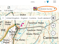
Just picked up a reference to the OS providing "the public with a source of information on the location and extent of greenspaces up and down the country. Greenspaces featured on the map include local parks, play areas, sports pitches and allotments."  See https://osmaps.ordnancesurvey.co.uk/  You do have to sign in and continued access comes with a charge. 

Frankly DEFRA's Magic Map Application seems better value at http://www.natureonthemap.naturalengland.org.uk/MagicMap.aspx as it is free.  Both only cover GB.  Though Magic only gives Natural England's information across England but not Wales.  (Though I gather the Welsh are moving onwards with their own mapping presentation.) I am not sure about what the Scottish lot are doing.
 

TheBitterEnd

Well-known member
FWIW bing maps https://www.bing.com/maps has OS maps for free, click the drop down top right that defaults to "Road" and select "Ordnance Survey" then zoom in. You only see the OZ map if you zoom in far enough but both 1:50000 and 1:25000 are available


Attachments

  • bingos.png
    bingos.png
    277.5 KB · Views: 430

Bob Mehew

Well-known member
The winning feature of Magic is it goes down to 1:10,000 scale and provides the detail associated with that mapping (like spot heights, field boundaries and so forth but not contours).  Bing takes you back to its road map.  Both have aerial mapping which for Bullpot Farm, Magic shows detail at sub 10m scale.  I will admit to using Bing most of the time since it has other information (like nearest coffee shops) but for detail, I go to Magic.
 

Vulcan

Member
'Where's the path' can be useful sometimes as you can view OS maps (as well as road maps/historical OS maps/bedrock types) next to satellite imagery so you can link surface features to OS maps.

Its also free.
 

Big Jim

Member
Plus Magic maps has many other useful layers that can be added eg 'designation' so you can see areas that have SSSI / Ramsars etc which may be useful for anyone involved in digging. I use it a lot, but often cross reference with UKgridreferencefinder or bing as some of the aerial imagery seems better than magic.

For public rights of way though Id use local authority maps as the primary source  - I'm not sure how up to date OS online maps are with PRoW.  Plus council maps will also show the footpath number which is useful for complaining if they are overgrown / obstructed.....
 

RobinGriffiths

Well-known member
The Bing OS maps are pretty good, and you can use their tile server api to fabricate your own mashup to combine 1:25,000 OS maps with whatever other data source that picks your fancy.

Robin
 

RobinGriffiths

Well-known member
Of course, how much better would it be if Cave Registries provided an api rather than having to hard code cave lists into a mashup web page ?
 

TheBitterEnd

Well-known member
JasonC said:
TheBitterEnd said:

Thanks for that - I was wondering how your Caves-on-a-Map page worked.  Easy, isn't it?  (no disrespect intended ;))
None taken, as Robin points out all the work is in getting the cave data not the maps. All credit goes to solocavediver formerly of this parish for the data I used on my caves on a map. Sadly he is no longer with us.

I could point you  at a suggestion I made for a way of indexing and sharing cave data but it turned into the usual UKC freshmeat feast last time and I am on hols at the mo so quite mellow, apart from having to type on a damned phone  ;)
 
Top