Mr Dinwiddy
Member
I have been enjoying looking for caves using Digital Terrain Model LIDAR.
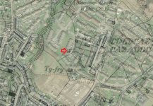
https://maps.nls.uk/geo/explore/side-by-side/#zoom=10&lat=54.22479&lon=-2.94377&layers=1&right=LIDAR_DTM_2m
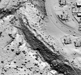
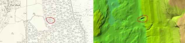
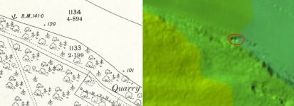
The side by side geo-referenced maps viewer allows you to put your mouse on a suspicious dark shadow on the LIDAR and the other "mouse" shows you where it is on the map. The big downside is that only the valley bottoms have been flown but its surprising the number of limestone areas that are covered. It is also maddening that some of the LIDAR stops just short of where I want to look.
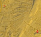
I have been setting the left hand map series as OS 1:25,000 (old but lovely) and the right hand series as LIDAR DTM 1m.
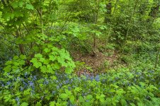
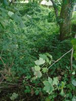
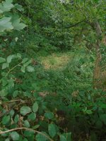
So far no new caves, but I explored (on my daily exercise) a small dry stream gorge I did not know existed and a series of tension release fissures on a scar edge. Both clearly stand out on the LIDAR which will also penetrate vegetation - great for wooded gorges and features otherwise hidden.
Hope you enjoy
DW
https://maps.nls.uk/geo/explore/side-by-side/#zoom=10&lat=54.22479&lon=-2.94377&layers=1&right=LIDAR_DTM_2m
The side by side geo-referenced maps viewer allows you to put your mouse on a suspicious dark shadow on the LIDAR and the other "mouse" shows you where it is on the map. The big downside is that only the valley bottoms have been flown but its surprising the number of limestone areas that are covered. It is also maddening that some of the LIDAR stops just short of where I want to look.
I have been setting the left hand map series as OS 1:25,000 (old but lovely) and the right hand series as LIDAR DTM 1m.
So far no new caves, but I explored (on my daily exercise) a small dry stream gorge I did not know existed and a series of tension release fissures on a scar edge. Both clearly stand out on the LIDAR which will also penetrate vegetation - great for wooded gorges and features otherwise hidden.
Hope you enjoy
DW
")