Collapse on Mud Hall traverse, Gaping Gill

Cavematt

Well-known member
Hi everyone

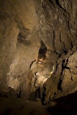
I have received a number of reports of a substantial collapse on the roped traverse ledge around the top of Mud Hall, connecting the Gaping Gill side to the Whitsun Series side. Details are a little sketchy at the moment as to the severity of the collapse (some reports saying it is no longer passable) and the exact location. More details will be posted on the CNCC website newspage as they are received. All groups and individuals with upcoming permits for Gaping Gill entrances have been informed by the Permit Secretary.

For now we advise on avoiding the area or taking substantial additional precautions until the details are clarified.

Matt Ewles
Secretary, Council of Northern Caving Clubs
 

Pitlamp

Well-known member
Does anyone know the date this happened? It was OK on the weekend of 30th October / 1st November (a fortnight ago) when cavers are known to have crossed the sediment wall without problem. It had certainly happened by Saturday just gone (11th November).

If others noticed it before 11th November, could you post a note here? It would be interesting to narrow down the date of the collapse and see if it's related to any of the earthquakes recorded on:

http://www.quakes.bgs.ac.uk/earthquakes/recent_uk_events.html

(If you look at this right now, note there's usually a short delay before the most recent events are reported.)
 

braveduck

Active member
Does not seem to be earthquake related .But once in Mud Hall and heard and
felt Horton Quarry blast .Since then the Quarry has got much nearer to GG on the West end.
 

Cavematt

Well-known member
Update on the situation here:

https://cncc.org.uk/news/collapse-on-mud-hall-traverse-gaping-gill
 

alanw

Well-known member
Here's a photo I took in May this year

MudHall.jpg
.

From the image on the CNCC site, it looks as if the collapse is between the person in red and the furthest person. There is a vertical rope coming down to the person in red which can just be seen on both images.

There is a yellow diagonal line on the CNCC image - I'd be interested to find out what that is.
 

alastairgott

Well-known member
From my severely Limited Viewpoint (above the chain) and from an annotated photo from an NPC member on our trip, I think the Collapse actually starts immediately after the man in Red.

The sheer angle above the far man has disappeared and is now a moderate-severe slope up from below his feet to above his head (or at least that was my opinion from above the chain).
 

Alex

Well-known member
The mud looks overhanging just beyond the person in red, so I assume that would be the most likely place of a collapse.

Its quite scary to realise as we all do I guess deep down, caves are very mobile and even places where you think are completely stable as they have not moved in many years. Something to think about I guess next time you crawl under any boulders.

I guess when your number is up, it's up, sometimes. I know of one case recently where that was the case.
 

Cavematt

Well-known member
I believe that some folks from the Craven PC are going to have a look over the next few weeks to try to identify a possible way forward. Watch out for updates here, or on the CNCC website or Facebook page.
 

Rachel

Active member
Alex said:
The mud looks overhanging just beyond the person in red, so I assume that would be the most likely place of a collapse.

Its quite scary to realise as we all do I guess deep down, caves are very mobile and even places where you think are completely stable as they have not moved in many years. Something to think about I guess next time you crawl under any boulders.

I guess when your number is up, it's up, sometimes. I know of one case recently where that was the case.

Very scary...that's me in the red, with my 10 year old and her friend. Even though we all know that traverse is made of mud and therefore must be inherently unstable, it's one of those places often taken for granted.
 

alanw

Well-known member
Badlad said:
alanw said:
alanw said:
Badlad: changed image width to fit on page

Just click on the image to see it at full size.

Hope that is ok.  It's a request we often get.  I can change it back if you prefer.

Not a problem, since there's such an easy way to see the original image at full size.
 

Basher

New member
Here is an image before the collapse for comparison.
 

Attachments

  • Mud Hall 2011-small.jpg
    Mud Hall 2011-small.jpg
    745 KB · Views: 308

pwhole

Well-known member
That's a great photo.

Out of interest, what were the traverse bolts actually fastened to? I was another who was there on Saturday (first time), and part of me just wanted to dash down there to have a closer look, but something (common sense probably) kept telling me not to.
 

Cavematt

Well-known member
We have a further update on the situation:

Following reports of a collapse in Mud Hall in Gaping Gill an inspection was organised by John Helm of Craven Pothole Club. On Thursday 16th November he was accompanied by Ian Patrick (CPC) and Simon Wilson (BPC). There has been a substantial fall of rock, clay and mud half way along the lower traverse. Some gardening was done and the traverse pathway (including the original in-situ rope) was reinstated as best as possible. This rope should be considered a route-marker only, and not a safe belay, due to its unknown integrity and anchorage. Although now passable, we recommend avoidance of this route until a more permanent solution has been found.

More updates will follow in due course.

Matt Ewles, Secretary, CNCC
 

Simon Wilson

New member
Here are photos to compare. The white arrow in the first photo marks the rope the caver is holding in the second photo. The white squares mark the same spot (I think). Much of the stuff above the caver in yellow is down in the bottom of the chamber. Some huge boulders came down. Photos belong to Martin Baines and John Helm.

Mud_Hall1-horz.jpg


image5.jpg
 
Top