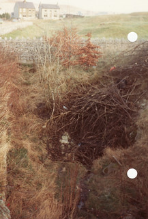
Dove Holes Tunnel

Goydenman

Well-known member
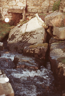
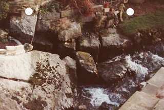
John North and I noted there was frequesnt trains through the tunnel so decided to visit the cave on a Christmas day thinking there would be no trains then. We made our way along and kept hearing what souneded like the noise of a train so darted into the alcoves but no train came so proceeded on. The noise was the river. When we got there we saw on our right a few metal bars low down and above a cave with waterfall. theer was no way we could climb the waterfall because there was too much water so we exited the tunnel. As we were climbing the banking to get back to the road a train came out of the tunnel!!!!
 

Mark

Well-known member
Went in back in the late 70s, climbed the waterfall, small passage, too tight, at the top, there were a couple of other inlets in the tunnel, but everything was too small.

I often wondered what happened behind the brickwork, on the other side of the tunnel
 

bograt

Active member
Downstream direction is in direction of Beelow (see armchair caving board), this could take it to either Wormhill risings or the legendary Coalpithole swallet. About the time the railway was built the ebbing and flowing well at Bennetson stopped.
 

Roger W

Well-known member
A bit of bang in the appropriate spot?

Or would it make the railtrack people - or whoever owns the tunnel now - too unhappy?
 

DAN

New member
If you are going comit a crime the Internet is proberbly not a good place to advertise it!
Dan
 

bograt

Active member
Been talking to one of my mates down the pub, he's a team leader on one of the local line maintenance gangs, he also has a numerically retentive brain. He recited a lot of numbers at me regarding the exact location of the inlets into the tunnel, based upon his information I got out the old slide rule and crayons, the results might interest some of you;

Lets start with the overall geological map of the area;
7161235442_33e0685b5a_c.jpg

This gives a general idea of the gritston/limestone boundary and the area we are interested in (marked in red as inset1), in relation to other features, Wormhill risings are unfortunately on the adjoining map, about 1Km south of the indicated point.

This brings us to inset 1;
7161237362_9305ccbca8_c.jpg

The tunnel is marked as the diagonal red line, about two thirds along to the southeast is an orange spot, this is the location of the inlets calculated from figures given to me and remarkably sits right on the junction between the softer white limestone and the harder dark limestone of the Monsal Dale beds, this hardness difference could be the factor which governs the flow in this area, general dip is gradual and to the North.
I have superimposed known caves onto the map to give some impression of the possibilities, the surveyed section of Cowlow Pot stops at a sump about 30m short of this boundary and about 250m from the inlets, but with the inlets being too tight, I don't see any point in pushing down there.
According to most reports, there are at least three inlets in the tunnel, this suggests each swallet reaches there seperately so to get accessible passage we need to look downstream to the north. Two possibilities stand out; Dove Holes cave and Bull Ring cave, both of which appear to be on or very close to the dark limestone boundary. Dove Holes cave is very close to the tunnel and may be the top end of Dove Holes Tunnel cave no.5 (C.O.P.D.), which ascends a total of 10m on the downstream side, with the calculated altitude of the inlets at 290m and the spot height of the church beside the cave at 331m this will give you 31m of vertical digging to end up in a railway tunnel, although it also gives you 31m to find horizontal development !.
Bull Ring cave looks like a promising prospect but 41m vertical in glacial crap is a long term commitment.
Over 1km north, beside the road junction at Barmoor Clough roundabout, someone opened up a shaft in the general position of the dark limestone boundary, there could be some related development down there, I don't know who it was (or is) but it could have been done with some insight.
As I have noted previously, the ebbing and flowing well at Bennetston stopped operating when they drove the tunnel, this is almost 2km away along the dip but sits on a knoll reef across the relevant dark limestone boundary.

On to inset 2;
7161240704_0d32d56230_c.jpg

This is a further enlargement of the area immediately around the inlets, additional points of interest are the small knoll reef and the minor mineral vein both situated downstream and straddling the dark limestone boundary. :sneaky:
 

Pipster

Member
Dan said:
Where is Dove Holes Cave?

If this is the cave I think it is....

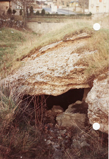
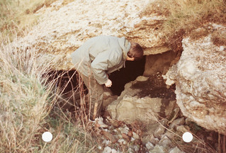
From Buxton Road, walk down Dale Road (opposite Station Road), past the houses. On the left is a public footpath which follows an old railway line. Take this path, but then head towards the small crags to the left and follow them north. Eventually you'll come around a small buttress (lots of rubbish just before to the left) with a the cave tucked just behind the other side. There is a short muddy crawl to enter a small chamber at the end where you can squeeze through a rift upwards, back to surface. Back in the chamber, a muddy dig down to the right seems to be the way on but it doesn't look inticing. I seem to the think that it looked like someone had had a go but gave up.

PS. I looked at this in the dark, a while ago, so these are pretty rough directions. However, there isn't much ground to cover and its fairly easy to find; just head to crags from the path and have a scout round.  :)
 

Pipster

Member
PS. We went to look at Cowlow Pot last year, only to find the entrance had suffered from a collapse and was blocked. It took a couple of hours to dig it out and we managed to regain access with a squeeze under a large block. However, care was needed as the block had potential to move. We've been intending to go back to persuade it out, but haven't yet got round to it. I'm not sure if anyone else has removed it since, but if anybody fancies removing it then feel free. Either way, if it no longer needs sorting, could you let me know. :)
 

bograt

Active member
7164212914_a51834afa9_z.jpg


According to C.O.P.D. grid references;
2 is Dove Holes Cave;
7164213300_cde6564d5b_z.jpg
,

and 3 is Bull Ring Cave;
7164213156_4664dfb8fa_z.jpg


1 is main tunnel inlet.

I think Pipster has found Bull Ring.
 

DAN

New member
I looked for both of these caves a few years ago and only found one of them which is the one in the side of the old railway cutting. You can do a really small through trip with a branch going steeply down to a dig. This i think is number 3 on your map the other caves i think have now been lost!

Dan
 

John B

New member
Good effort on compiling the maps. Bear in mind that the dip is westwards, so that a geological boundary outcropping at the surface will be a long way west at the level of the tunnel. Assuming that the lavas dip west at Dove Holes, the drainage has to get through them to go east to Wormhill. I always thought that the drainage would follow faults to achieve this, then flow south east to Wormhill Springs along the axis of the syncline that runs through Bole Hill and Withered Low, below the Upper and Lower Millers Dale Lavas, the roughly concentric red outcrops. There are small sinks round the lower outcrop. It would be a good one to crack - 120m+ vertically and about 7km horizontally!
 
Top