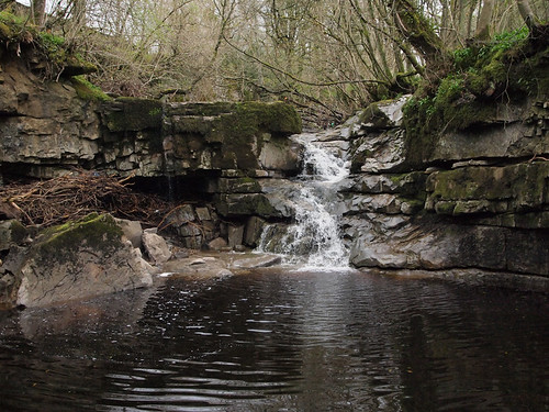
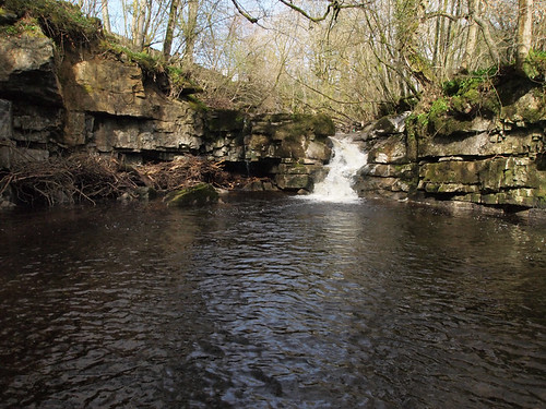
Flood pulse in Kingsdale

Bob Smith

Member
[quote author=TheBitterEnd]I had something like ?50 in mind for weatherproofing alone - decent enclosure, glands, sealants, potting/conformal coating, etc, etc.
[/quote]
Really? I've put together a pressure sensing logger that did greater than 300m for around ?50 for all the components. I think this could be done on quite a slim budget, but as you say maintaining this could be difficult. My power budgets are tiny compared to the data I'm expected to collect, so I seem to have gained a skill in that area as well. I suspect this idea could seriously interfere with my full time employment if I'm not careful.
 

Pitlamp

Well-known member
kay said:
Natural England have a rain gauge at Colt park, at about 370m (or 40m lower than GG) - would it be worth asking if you could get access to their readings?

The problem with this - and others such as MTFC - is that they're generally at the level of the limestone bench. As a (very general) principle it's the rainfall on the non carbonate rocks at higher levels which really matters - the main catchment for the streams usually sinking as soon as they encounter the limestone bench,

So it would need some gauges very high up, to do this properly.

Some method of measuring tempereature would be advisable; often when there's rain at low level it comes down in flakes at high level - which of course doesn't really count (until the white stuff melts). There is a lot to take account of whilst designing this experiment but it's well worth doing.
 

Fulk

Well-known member
There was also a 'mild' flood event on Dentdale last Sunday. The first picture shows the entrance to Ibbeth Peril Cave at about 2?45, when the trickle of water had just started to increase:
8720125488_3db7a20184.jpg


We wandered off and came back about an hour later to find this:
8720125028_379811cc55.jpg


In this context, 'mild' flood is appropriate, as in a really 'good' one, the whole cascade disappears under a raging brown torrent; I have never seen it, but I am told that in extreme cases you could look at it and be unaware that there is a cascade there at all.

The entrance to the cave is just to the left ('true right', I guess if I was going for this week's pedant award) of the cascade, where the obvious black hole is; you descend a little drop, then the passage drops further to a short flat-out section. I imagine that this section would have been sumped off by the time the second picture was taken. I guess that the total drop, from the 'platform' at the top to the left of the cascade to the flat rocks below in the first picture must be about 4 metres.
 

JJ

Member
Regarding rain gauges high up in the Dales.

There certainly used to be one at High Pike between Kingsdale and Deepdale SD 71795 82412 I am sure that I have found the records online in the past, but that they were only monthly readings (quick search now has not found them). There also used to be another above CrummacK Farm SD 77010 71944, not sure if it is still there.

Interestingly the National Park have just given planning permission for two telemetered rain gauges one at Beckermonds SD87368 80743 at the top of Langstrothdale and the other near Spittle Croft, Littondale SD 90107 74286. Both are being installed for "flood water purposes" I assume the Environment Agency, hopefully they will be web enabled.
 

Whale

New member
Maybe the Met Office already has the necessary information from detailed records of precipitation intensity via radar returns?

I would imagine that they also have the software to compute intensity x time x area; although it will probably be 'costly' to get the level of detail required but may be worth following up this line of investigation?

Cheers

Allan


TheBitterEnd

Well-known member
A reasonable amount of Met Office data up to 2006 is available for download (free registration required) but I'm not sure where we are going with this. The original hypothesis was that under certain conditions it rains more at high level than low level and hence we see the situation that we had on Sunday.

Well... I doubt it needs years of research to prove that sometimes it rains more in one place than another and that sometimes the effects are highly localized.

So either we want to establish what conditions lead to significant rainfall on the tops when there is little lower down or we want to establish the relationship between high-level rainfall and subsequent run-off into caves.
 

dunc

New member
Drizzle should never be underestimated!

Is it possible the recent and fairly prolonged dry spell we've had dried the ground so any rain/drizzle that did fall ran off quicker than one might normally expect?  :confused:
 

TheBitterEnd

Well-known member
So is it a soil moisture meter we need?  :confused:

Seriously, fair point Dunc and one that I believe is especially significant with respect to summer thunderstorm type rain, i.e. intense rainfall, we have all tried watering a dried out pot-plant.

I'm beginning to think that it would be more useful to relate a cave hydrograph to high level/low level rainfall
 
The surface above West Kingsdale was damp on Saturday, Sunday & Monday, although it seemed slightly less wet on Monday. On Saturday it was not pleasant at the level of the West Kingsdale entrances although it was tolerable a bit lower down.
On Sunday  it seemed to get wetter  in mid-afternoon.
Monday was almost tropical on the surface
Perhaps those who were underground on most of those days (GC or TA) could give a more informed opinion.
 

barrabus

New member
Fulk said:
The entrance to the cave is just to the left of the cascade, where the obvious black hole is; you descend a little drop, then the passage drops further to a short flat-out section. I imagine that this section would have been sumped off by the time the second picture was taken.

Fulk - a few years ago DT, TD and myself (if I remember correctly) made a quick trip (~30-40 mins - again, if my memory is correct) into Ibbeth Peril when the water levels were similar (possibly a bit higher). There was plenty of water flowing down the low section of the entrance passage but it definitely wasn't sumped. The usually small waterfall that flows into the main chamber was a huge torrent approximately 20-25 feet wide and another torrent was cascading down the wall to the right of it.

I would add that it was probably rather stupid to go in the cave under these conditions and certainly would not recommend it to others.
 
 
Top