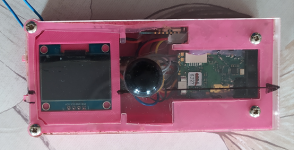
Having purchased an SAP just over a year ago and now used it a few times I thought I'd write a review...
Before continuing I need to mention a couple of things:
- I'm new to surveying; my first was completed in 2019. Basically I realised we needed to be able to survey our finds on Portland and so with zero prior knowledge I decided to learn the hard way by working it out for myself.
- We started by using a compass & cheap laser measure soon discovering that using a compass was 'very boring' and so went in search of alternatives.
- I've no intention of getting into surveying in a big way, it's simply a tool to aid exploration & documentation on Portland.
- I've never used, or even seen a DistoX to compare it to.
Having gone looking for alternatives to a compass plus laser measure I discovered there was basically two options; an SAP or DistoX. Naturally I looked into both. As fas as I could determine the DistoX required purchasing an off the shelf instrument for around £150 and handing it to someone else with another £150 to modify the internals (and hence voiding the warrantee). Furthermore it required a PDA or smart phone to use alongside it. Being a Luddite and owning neither my estimate was that it would cost around £500 to set myself up. It also seemed like the parts for the DistoX conversion were either limited or not available. On the other hand the SAP appeared to do all I need and was available 'off the shelf', so to speak, for £165. To be honest I thought long and hard about spending £165 in case it was junk but decided to take a punt and I'm pleased I did.
I placed the order whilst they were out of stock knowing I'd have a wait. The SAP turned up about 3 months after ordering, but as we were in lock-down at the time, the wait didn't really matter. Obviously the first thing I did was attempt to survey my home. Lesson number one – these things don't work in close proximity to metal. Surveying cooker to radiator to light switch to door handle gave some interesting results. After a bit of swearing, and then some thought, a second attempt of sink (ceramic) to bookcase (wooden) to desk (wooden) to table (wooden) showed the device did work and the previous attempt was a failure due to the muppet using it. Fortunately there's little metal in caves, however it did highlight that using a bolt as a survey station would be a mistake. What was quickly apparent was that scrolling through the menu on the SAP by tilting would take some getting used too.
On to the underground...
Firstly, getting the hang of it has required quite a bit of practice and fair amount of bad language however I reckon I've pretty much got it now (7 surveys later). My overall assessment could be summed up by 'it's very nearly brilliant'. In comparison to 'compass plus laser measure' it's much quicker, and easier, and if like me you have projects which will need the ability to survey occasionally it's certain worth the money. I do feel as though there is scope for improvement; with zero knowledge of electronics, and therefore no valid opinion, some of this does feel quite easy to fix.
The biggest issue in my opinion is the system of scrolling through the menu by rocking the device. Personally I'd rather see a couple of other buttons on it; up, down, select or similar. The rocking action needs a controlled and quite specific action to get it to do what you want every time. The key is to not be too fast, making each tilt a very deliberate movement. On the surface this is fairly quick to master, but led down in a compromising position or wedged in a rift unable to move your arms properly, this can be a challenge. It does come with practice though and during my last two surveying trip I managed to take 204 and 285 shots from 42 and 58 survey stations respectively without cocking up once. Despite getting the hang of it I'd still rather a couple extra buttons! I've also had to rule out handing it to someone else and asking them to take a shot or two due to the amount of practice required to use it.
The second issue is that when you accidentally save a shot with the wrong station number, cock up aiming the laser or accidentally survey the inside of your pocket there's no option to delete or amend the shot. The result being that you end up having to record the error manually and then sort the data when uploading later. In my opinion this is an unnecessary source for error. Now I've got the hang of the menu I'm not making the mistakes which made me want this, but certainly this lack of option to delete a stored shot has frustrated me at times. In a similar vein there's no ability to force it to start a new survey. The device is set to automatically start a new survey after 8 hours inactivity. I dare say this is fine in most cases, but was a minor annoyance when I surveyed two short caves in the same morning. The solution was to split the data on the computer later having made a note of the split point manually.
Other people have mentioned poor battery life. This is not something I've had a problem with. The longest survey I've done so far using my SAP was Steve's Endeavour, recording 220 m in length taking 285 shots from 58 stations. The average shot length was around 3.5 m, which, now I've done a few, seems pretty normal for Portland's gnarly rifts. This left approx. 20 % battery remaining. Having taken around 3 hours to do this my opinion is the battery life is more than sufficient for a single surveying trip. With a longer shot length between survey stations, which I'd guess would be more likely in a standard water worn cave, I'd struggle to see there being a problem with surveying 400 to 500 m of passage in a single hit. If I remember correctly the specification states the battery is good for around 300 shots; I guess that sounds about right from what I've seen, perhaps a little conservative.
One other thing I've noted is that the laser strength is insufficient to use outside in bright daylight. When attempted on a sunny day, it was impossible to survey between 2 entrances to get a height difference as we couldn't see the beam on the target. Obviously I could have returned at night or on a dull day, so not impossible to overcome. As it turned out the height different wasn't needed - the caves went in differing directions. For comparison I tried both the SAP and cheap laser measure outside at home and found the laser measure to have a significantly stronger beam. Underground the longest shot length I've recorded with the SAP was 27 m down a pitch and that was easy to see so it's clearly not an issue in the dark.
Finally I thought it would be useful to give an example of what I've done with it. Once back at home it's very easy to get the data off the SAP using the software provided and into Excel (or equiv.) to manipulate. Other than rectifying any mistakes, the main sorting required is changing the survey station identity for the splayed shots as it defaults to 255 for all (which is quite annoying). XXa, XXb, XXc, etc. would be better. It's also necessary to add a prefix where multiple datasets are going to be joined as each survey always starts from station 1. All trivial with some basic knowledge of excel formulae. Having played briefly with Therion and decided it's a level of frustration I can do without in my life I discovered it's much easier to get a centreline survey and produce google earth overlays from Compass. I've then used Inkscape to produce the final drawing. This is our recent survey of Steve's Endeavour / Hopeless Hole; A total of 100 survey stations and 489 shots.