

You are using an out of date browser. It may not display this or other websites correctly.
You should upgrade or use an alternative browser.
You should upgrade or use an alternative browser.
Underwater stalactites in the Dales
- Thread starter Pitlamp
- Start date
gus horsley
New member
Phreatic waters carry smaller particles in suspension because they tend to be slower moving so I would think that abrasion of stals underwater would be relatively minor compared to vadose systems where an uncommonly large flood pulse could theoretically destroy stals within seconds.
graham
New member
gus horsley said:Phreatic waters carry smaller particles in suspension because they tend to be slower moving ...
I think Pitlamp is the best person to comment on that.
gus horsley said:... so I would think that abrasion of stals underwater would be relatively minor compared to vadose systems where an uncommonly large flood pulse could theoretically destroy stals within seconds.
The key word there is theoretically. The only case I can think of is the 1968 Mendip flood which moved a few bits around somewhat. (Having first filled the cave to the roof, paraphreatic?)
Pitlamp
Well-known member
OK folks, here's my take on it. Traditionally vadose caves were known to be mainly influenced by physical erosion ("corrasion") and phreatic passages were thought to be formed essentially by solution. That was probably because few or none of the people researching speleogenesis studied active phreatic passages (quite reasonably because they weren't divers).
Cave diving became more common in the 70s but even then it was regarded as a relatively extreme technique. Those few who did it were more interested in their own survival than in studying the underwater passages - there was still a fairly widespread attitude around then that a cave dive wasn't actually justified unless there was a good chance of breaking airspace in new dry cave. All that changed with the quantum leap in techniques which came in the late 70s based around the discoveries at Keld Head. People psychologically accepted long submersions, which brought the possibility of spending time doing other things than just focussing on mere survival. So there started to be comments in CDG Newsletter dive logs which were of scientific interest. (One of these was Geoff Yeadon's mention of finding submerged stal at 4.5 m depth in the Marble Steps Branch of Keld Head, for example, circa 1976.)
This trend continued and nowadays certain UK cave dives are done where the main aim is scientific study of the passages. However, most cave diving is done when conditions are at an optimum; low flow and clear water. To see what's really happening with the sediments you have to go there in flood conditions. In many cases this isn't possible in safety. However, certain places sometimes allow us a glimpse of what really goes on in raging flood. Chapman's Rising in Chapel-le-Dale is one such place. After the entrance slot there's 5 metres of rift passage to a 5 m pot down to the main passage. The current howls up this pot in wet conditions and it can provide a fascinating spectacle if you can hang on to avoid being blown out by the fierce current. It's possible to watch great cobbles being blasted UP this pot. When they reach the top they go sideways and drop onto ledges, then rattle back down. Some get back down the pot, only to be blasted up again. Some are caught in the current before they can redescend the pot and are sent back round again, several times. All these cobbles make an incredible noise as they batter the rock walls.
So, not only are large lumps of abbrasive sandstone being transported along; they're going backwards and forwards all the time, almost like a giant file, when considered over the timescale of cave development. Another example is Hurtle Pot; you can't go there when it's in full flood or you'd probably not make it out again. But just downstream from the entrance there's a big (many metres across) pot rising from about -10 m up to about -4 m. In this pot are some enormous cobbles (known to some as the "dinosaur eggs"). We're talking 60, 70 or maybe 80 cm long cobbles here - far too big to pick up. They're always in a different position after every flood and the walls of the pot are pockmarked as the boulders get hurled against the limestone bedrock. I think this is what geologists call "corrasion".
Another example is the Ramp in the Leck Beck Head sump; here hundreds of tons of big pebbles sit precariously on a steep slope up from -30 m to -9 m. In flood they get shoved upslope, only to collapse and come roaring back down, wearing away lots of limestone in the process. (Exactly the same thing probably happens even today in high flood on the entrance ramp of Sleets Gill Cave, which is essentially the same sort of feature.) I could go on and quote many other examples. I could describe underwater rockmills ("moulins") in sumps, with great round pebbles being swirled around. I could mention what look almost like vadose canyons in sumps, perhaps caused by the sediment load being nearer to the floor (due to gravity).
Anyway, hopefully the above convinces anyone who is sceptical about the role of physical erosion in the phreatic zone!
gus horsley
New member
Doh, I felt a bit of a berk after reading your last post Pitlamp, remembering the reports of the Slot in Llygad Llwchwr. My only experiences of diving are free diving short sumps, but these phenomena you described: is the water travelling through a sump actually pulsing or is it mainly a steady flow and, if a passage is completely submerged, do you get variations in water pressure during a flood?
Pitlamp
Well-known member
Ah yes - I'd forgotten about the LL Slot. I must confess I've never been there but I know people who have actively tried to pass it and I can remember their descriptions. My own experience of low slots with fast flow includes the one in Far Sump. I once had to abort a dive because, although I probably could have clawed my way through, gravel was being cannoned against my mask and I thought it might shatter. Imagine the erosive effect of this grit blasting on the rock in the vicinity.
I'm not sure I exactly understand your questions above, but here's my take on it. The flow in flood in a sump is "turbulent" (as opposed to "laminar" in extremely low flow). So yes, I'd expect sensitive instruments could measure frequent small pressure changes. As for "pulses" - again I don't understand precisely what you mean but at any given point there are certainly changes in speed (again due to turbulent flow). Certain sites show dramatic "pulses" however - perhaps the best UK examples being Speedwell's Main Rising and Whirlpool Rising sumps. These are natural siphons and the flow rate out of these sumps can vary between a mere trickle and a raging torrent over a (regularly repeated) period of around 10 minutes. Unless this has been directly viewed (especially in a smallish passage such as Whirlpool Passage) it's difficult to believe it really happens.
In some sites where there's a restriction at the downstream end (such as the partly choked Leck Beck Head) water can back up further upstream. In the above example the main downstream sump in Lancaster can back up around 30 m in the very highest flow - when it forms a deep ominous lake in Fall Pot. Under these conditions the normally dry passage immediately prior to the normal sump pool will be at a pressure of 4 atmospheres! (The pressure in the sump will be whatever the normal pressure is plus the extra pressure caused by the backing up; so the pressure in much of the sump, which is mostly over 30 m deep normally, will be over 7 atmospheres.) This is an extreme example but the same probably happens to a lesser extent in most sumps carrying a high flow in flood conditions. So yes, over the course of a flood event there will probably also be a rise, then fall, in pressure at any given point in the sump.
Does this help?
the main downstream sump in Lancaster can back up around 30 m in the very highest flow - when it forms a deep ominous lake in Fall Pot.
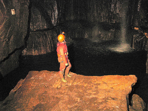
Here's a snap ? sorry about the quality, I was using a digital camera underground for the first time for this 'once-in-a-lifetime' picture:
What you say about the conditions underwater in flood, John, is amazing. 'Awesome' is not a word I use often, but it might be appropriate in this context!
Pitlamp
Well-known member
Superb image; if my "best" photographs were as good as what you consider to be poor ones, I'd call myself a photographer!
Incidentally we once left some gear bolted to the wall near the downstream sump in Lancaster. Before we went back the place flooded as in your picture. One of those white plastic pots with a red lid had been completely crushed by the pressure. As I remember it hadn't actually leaked but there was an imprint of the contents extruded out of the walls of the pot.
Don't we just have some lovely weather in the Dales sometimes?
Don't we just have some lovely weather in the Dales sometimes?
You mean, like now
 ?
?gus horsley
New member
Pitlamp said:Does this help?
It does actually. Thanks mate.
