graham
New member
Cookie said:Name of the passage: Rolling Thunder
Name of surveyor: Couldn't possibly say :")
Is there an "L" in the name?


Cookie said:Name of the passage: Rolling Thunder
Name of surveyor: Couldn't possibly say :
anfieldman said:A tape can bend causing inaccuracies. Laser light as we know does not bend.
Cave_Troll said:anfieldman said:A tape can bend causing inaccuracies. Laser light as we know does not bend.
Actually light can and does bend.
However the effect is not likely to be noticable by you down a cave unless there is a small Neutron Star in the next chamber.
graham said:If you use a body as a target, how do you define the station position with any degree of accuracy?
footleg said:Secondly, it is difficult to hold the spot steady on long (20m+ legs). But if you choose your target carefully so there is not anything next to it where the distance will be very different (e.g. choose a flat wall or stand in front of it and use your body as a target) then this can be overcome. Double check long readings to be sure. We rarely get legs over 10m anyway in my personal experience.
, but managed 20m legs OK.Robert Scott said:Have you considered using a "lolly" as in this Avalon item
http://www.scavalon.be/avalonuk/technical/laserclino.htm ?
footleg said:Having just spent a week surveying with a laser measure for the first time, I can provide some first hand feedback.
Firstly, it is far, far quicker than surveying with a tape. Especially for Left,Right,Up,Down readings and when only 2 people are doing the surveying. Allows the sketcher to keep their hands clean for drawing too.
Secondly, it is difficult to hold the spot steady on long (20m+ legs). But if you choose your target carefully so there is not anything next to it where the distance will be very different (e.g. choose a flat wall or stand in front of it and use your body as a target) then this can be overcome. Double check long readings to be sure. We rarely get legs over 10m anyway in my personal experience.
Thirdly, the laser is a great help in choosing stations, as it instantly indicates which points along the passage are visible from the last station when the user shines it around from the last station.
Finally one drawback we had not anticipated. One of our team was red/green colour blind, and could not actually see the spot of the red laser on mud and rock!
Overall I was completely sold on them. We worked as a pair, me drawing and recording the figures, and my survey partner reading the instruments. I set stations and used my hand as a target, so no problems with reflections off difficult surfaces. Surveying in wet cold conditions was fast and efficient. We could also measure the heights of avens. Got a reading of 35m up one, so reflections off rock are possible over long distances.
Ouan said:Our accuracy wasn't brilliant: one 100m loop had a 6% closure error and a 92m loop had a 3% closure error.
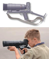
Charlie said:A few years ago I met an action photographer who used one of these devices http://www.electromax.com/fotosnipercamera.html
