
I come from a caving family but personally I spend most of my time underwater. Underwater I did a lot of 3d photogrammetry until a helicopter ride this summer caused a dry spell - so I decided to buy a UAV.
I have had 2 UAVs end up in the water and realise they are not the best tool for underwater photogrammetry so have had a play with some topside photogrammetry instead. Growing up on Mendip I know of no better place to see contrasting topography than Charterhouse, so I scanned it.
The 3d model can be found here: https://skfb.ly/6DnB8
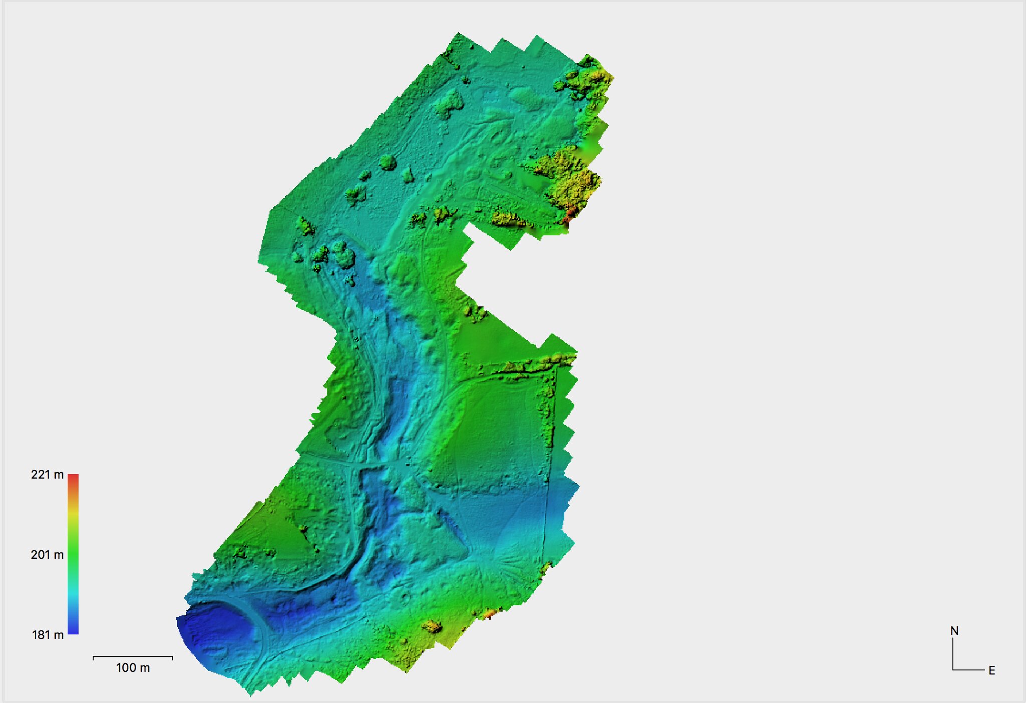
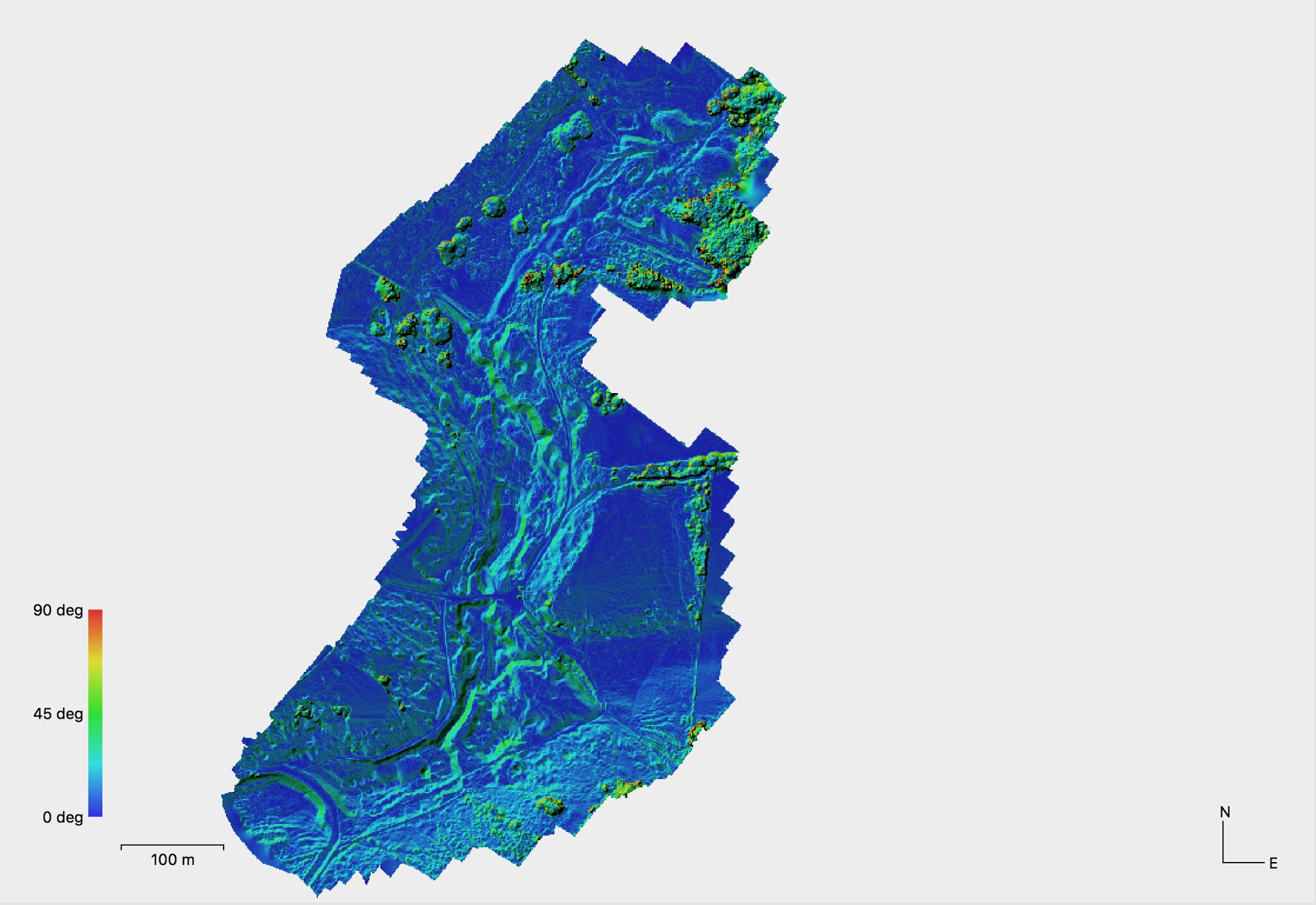
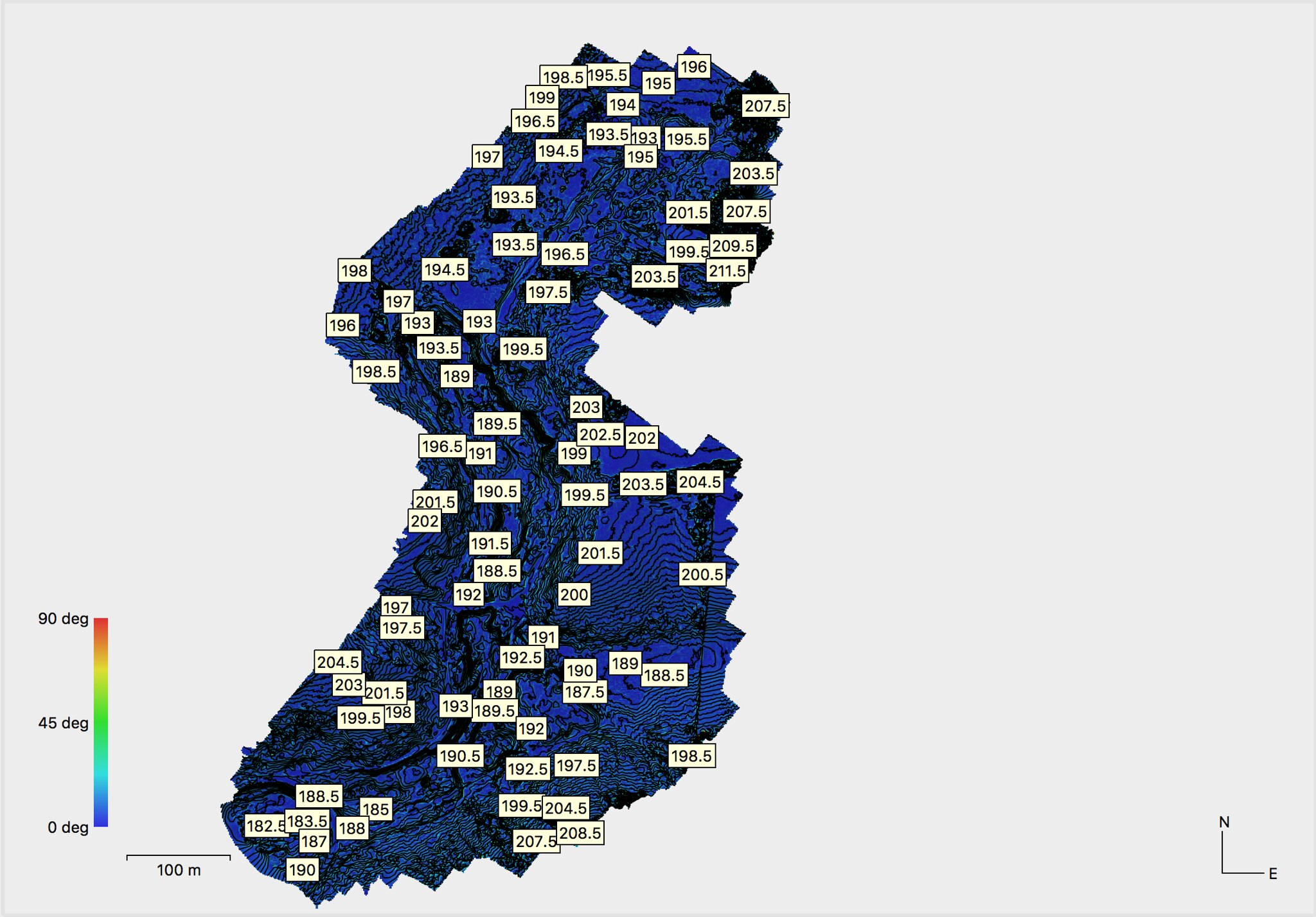
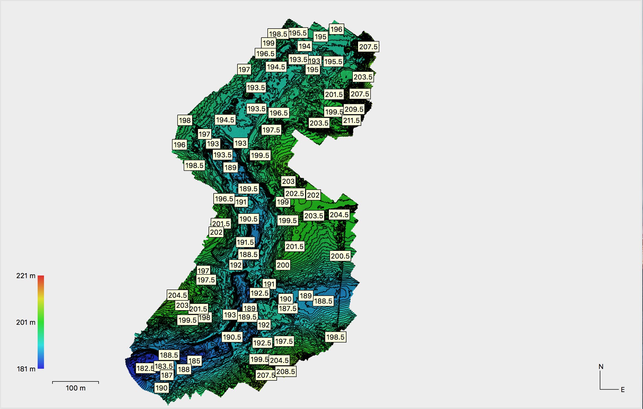
I am currently processing some Digital Elevation Models showing altitude and slopes. I will upload these as and when they are complete.
I have had 2 UAVs end up in the water and realise they are not the best tool for underwater photogrammetry so have had a play with some topside photogrammetry instead. Growing up on Mendip I know of no better place to see contrasting topography than Charterhouse, so I scanned it.
The 3d model can be found here: https://skfb.ly/6DnB8
I am currently processing some Digital Elevation Models showing altitude and slopes. I will upload these as and when they are complete.