oldmaps site to shut.

rjw

New member
As title. The oldmaps.co.uk site will close permanently on 31st October. No reason given.

Probably due to people like me who spent hours on the site but never bought anything  :-[

I'll miss all the stuff from the 50s and 60s especially. Love the cartography and fonts from those eras.
 

pwhole

Well-known member
Yeah, but nowhere near as many issues of the maps. The later non-OS ones are useless, being at too large a scale, and they only feature one Victorian 25-inch map - Old Maps often has ten, stretching over a hundred years - that was the best feature, being able to see changes over time, especially where mines are concerned. Most of the ganister mines in Sheffield for example, only opened between about 1905 and 1940, so you can't see any of those on the NLS site maps as they're too old!

The trouble is, the Old Maps subs model was hopeless - I don't want prints for my wall! I would happily have paid a browse-only subscription, had they ever offered one, but they didn't. You could register, but it was unclear if you had to pay from then on if you didn't want prints - they're just too coy with the relevant info. Their FAQ on subscription just takes you to map print prices, but doesn't mention browsing-only, even though they state enhanced zoom is the main bonus of a subscription! I'm not surprised they're going out of business, as their business model is somewhat bizarre, but their stock is good, and I hope some other means of using the content is produced.

https://www.old-maps.co.uk/#/Pages/Prices

Personally, if I do ever want to actually buy old OS maps as prints, admittedly only of the date released, I get Alan Godfrey maps, as they're very cheap, and very high quality print, and usually with a lot of historical info printed on the back - I have many of thee Sheffield ones, and they're superb for the price:

https://www.alangodfreymaps.co.uk/
 

Dave Tyson

Member
rjw said:
As title. The oldmaps.co.uk site will close permanently on 31st October. No reason given.

Probably due to people like me who spent hours on the site but never bought anything  :-[
I only just spotted this a few days ago. Was poking around looking at old lead mine sites in Minera. Like you I never paid a bean, but would have been happy to throw a few quid in their direction to be able to download stuff - I didn't want a picture to frame. If you pulled down fragments you could print them and scissors/sellotape made a reasonable job or stitch them together in GIMP. They were better a few years ago when you could zoom in further...

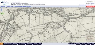
The NLS site is OK, and before they fixed the bug you could fiddle with the URL and pull down a complete sheet - managed to save a few before they stopped it  :mad: But they are only 6"/mile and lack the breadth of coverage that old maps had.

For people who have academic connections then you used to be able to get old maps off the O/S site. I think JISC set it up and you just needed to request  login credentials. I used it about 15 years ago - not sure if its still available now

Dave
 

pwhole

Well-known member
To be fair to the NLS, they do have a very good set of earlier maps - if you're lucky, from the late 1840s - mostly cities though. But superb quality, and with much better zoom:

https://maps.nls.uk/os/townplans-england/

With this I was able to prove there was once a shaft in what's now Bingham Park in Sheffield, which was just about visible in the 1:10000 (poor) scan on Old Maps, but not conclusive. No idea what the shaft was for, as it's about half a mile from the nearest colliery that was open at the time (Greystones and numerous old pits around Dobbin Hill), and the coal seam isn't where the shaft is. But that's the fun of the game :)
 

rjw

New member
Looks like it wasn't our fault after all. Now it's shut there is more of an explanation on the Landmark Information Group blog.

"Why is Old Maps no longer available?

Over the last 10 years Landmark has partnered with the team at Old Maps to sell our historical mapping data to consumers keen to learn about local history or purchase printed maps for personal or decorative use. Viewing and printing these maps from the Old Maps website was limited under our license agreement to non-commercial users.

Over the past 12 months, it became apparent that some of our professional services users were not clear about these restrictions and were choosing to use Old Maps as a reference tool as an alternative to accessing and purchasing historical maps under commercial license terms.

As a result we have decided to focus our efforts on clarifying and improving our historical mapping offer to the professional services market. Regrettably, this means that we are no longer able to offer consumers access to the Old Maps website."


So, companies/professional individuals were using the online viewing to gain information to sell on as part of their services to clients. No doubt not reducing their fees to reflect the poorer quality maps. Very diplomatically put by Landmark I thought. Hope they get booted out of whatever professional bodies they belong to, but they won't. Scheming little shyster s**tb*g weasels.

Glimmer of hope:

"Do you offer a subscription service for viewing historic maps?

We do not currently offer a general subscription service for viewing our historic map library, but this is an area we are hoping to make available in future. If you?d like to join the waiting list for early access to this service please drop an email to our customer service team and we will get in touch once we have further news.

If you have any further questions please contact our team at customerservice@promap.co.uk
"

Maybe individuals, clubs/societies, even higher bodies might consider emailing?


Jenny P

Active member
Worth noting that the British Caving Library has a considerable number of old OS maps in its collection, some going back before 1900. 

There are a collection of large scale maps of caving areas of the Dales which once belonged to Eli Simpson, some being annotated by Simpson and others to show cave features - only some of these have been catalogued so far. 

Other maps came with the John Beck / Doug Nash collection of surveys and maps and are mostly from the Peak District - two volunteers have only just finished cataloguing the 1000 or so items.

We also have some 1970's aerial photos of parts of the Peak District which show features since obliterated.

Our website is  caving-library.org.uk  but please note that the map and survey collection is not yet included in the existing online bibliography/catalogue, you'll have to contact us and ask if we have what you want.  We'll do our best to help.


Jenny P

Active member
pwhole also mentioned ganister mines:

"Most of the ganister mines in Sheffield for example, only opened between about 1905 and 1940, so you can't see any of those on the NLS site maps as they're too old! "

The Library does have maps of the explorations for ganister sites in the Peak District after WWII - they were part of John Beck's collection.
 

langcliffe

Well-known member
Dave Tyson said:
The NLS site is OK, and before they fixed the bug you could fiddle with the URL and pull down a complete sheet - managed to save a few before they stopped it  :mad: But they are only 6"/mile and lack the breadth of coverage that old maps had.

The NLS site does have 25" maps, which I make extensive use of. E.g. https://maps.nls.uk/view/125633461
 

ILT

Member
"Over the past 12 months, it became apparent that some of our professional services users were not clear about these restrictions and were choosing to use Old Maps as a reference tool as an alternative to accessing and purchasing historical maps under commercial license terms.

As a result we have decided to focus our efforts on clarifying and improving our historical mapping offer to the professional services market. Regrettably, this means that we are no longer able to offer consumers access to the Old Maps website."


So professional users were abusing the system.....

...the solution

....we'll ONLY sell to the professional users


Or am I getting confused again?
 

pwhole

Well-known member
The NLS site appears to have trimmed its maps back - the link I gave before, which allowed me to see Bingham Park in Sheffield? Now the tiles don't extend that far! Weird - I wonder if the two developments are related? I still don't understand why the OS can't provide an archive site that shows every OS map ever released, right up until the last print edition.

Edit - aha - found it - it seems to have moved from one category (Town Plans) to the standard 25-inch category. Phew! Still no resolution as to the provenance of the shaft though - bang in the centre of the image :)
 

Attachments

  • BinghamShaft.jpg
    BinghamShaft.jpg
    135.1 KB · Views: 153

Dave Tyson

Member
langcliffe said:
Dave Tyson said:
The NLS site is OK, and before they fixed the bug you could fiddle with the URL and pull down a complete sheet - managed to save a few before they stopped it  :mad: But they are only 6"/mile and lack the breadth of coverage that old maps had.

The NLS site does have 25" maps, which I make extensive use of. E.g. https://maps.nls.uk/view/125633461
Sadly the number of maps covering North Wales the larger scales ( the area I am interested in) is rather small. I agree there is better coverage elsewhere
Dave
 

mikem

Well-known member
The old OS for charterhouse rakes on Mendip shows a shaft - unfortunately it's actually the base of a chimney!
 
Top