Preferred software for 2d and 3d visualization of PocketTopo data!?

Apocalypso

New member
Hi,

I'm totally new in cave mapping and now I'm experimenting with combination of DistoX and PocketTopo and now I'm curious what software you are using for post-processing that you collect with Disto? Is there any software capable to automatically calculate length, depth, volume and stuff like that?

Sorry 4 my English by the way...  :-[
 

andrew

Member
Most of the UK import it into Therion, probably mainly my fault.  This can automated with topParser, automatically showing the 3d model if the correct software is installed. The development version of topParser also imports into survex. Tunnel also has a direct import. All these will give the information required, the chose comes down to how you intend to draw it up.
 

Apocalypso

New member
Thx for the answers, I already found some tutorials about importing Pockettopo data to Therion and it indeed looks like the best possible option.

Also I'm graphic designer and working with vector based software such as Illustrator and Corel on a daily basis and therefore I'm actually planing to use combination of mentioned programs for 2d maps and for that purpose it would be enough to just import and scale sketch made with Pockettopo!? Or it is better to process everything with dedicated software like therion and than export and kind of final touch in Illustrator?

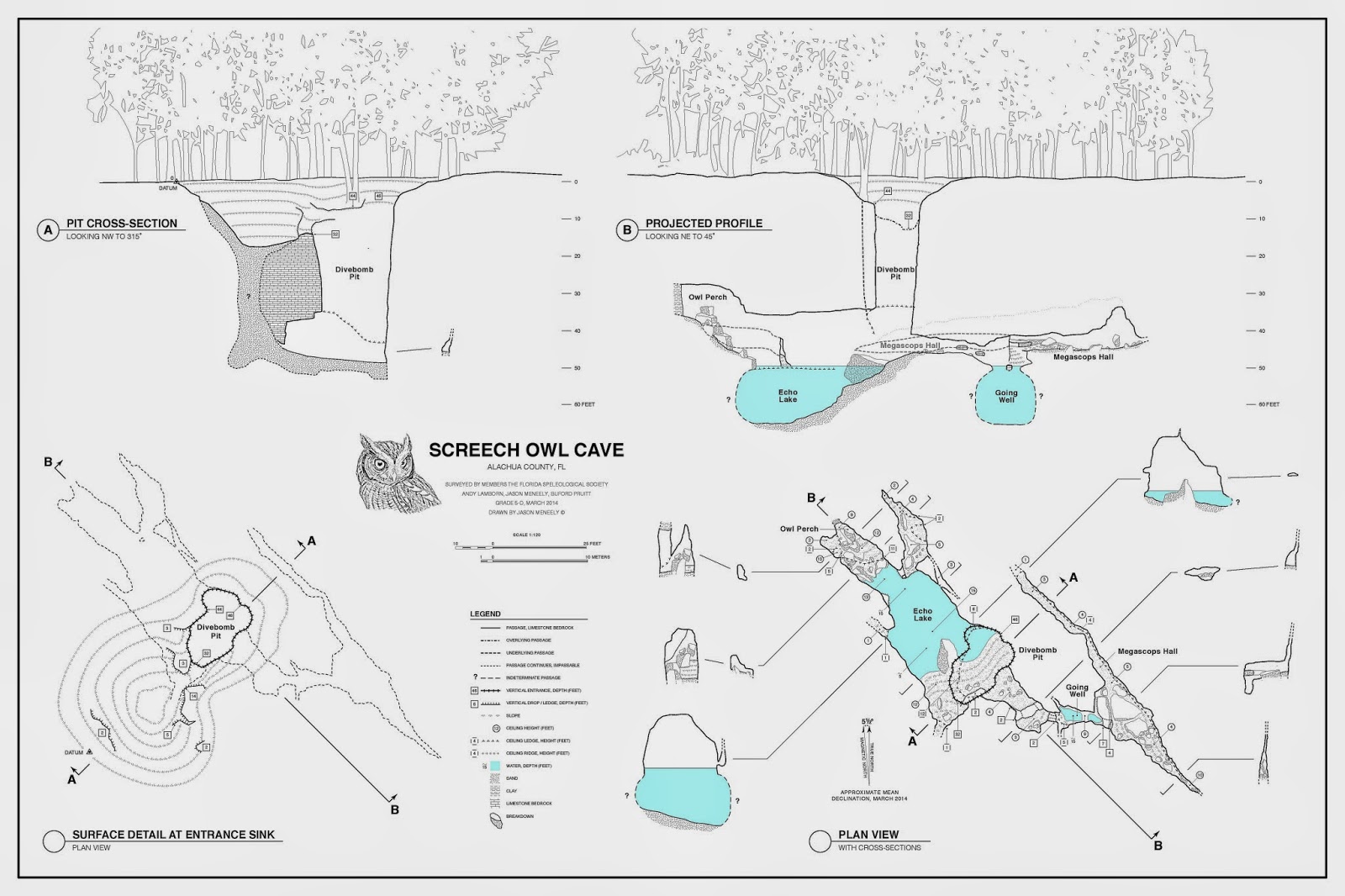
Last but not the least, what is the best solution for creating projected profiles such on photo embedded below, because in some specific situation I need both, extended and projected profile. 

Screech+Owl+Map+JMeneely+2014-page-001.jpg


Sorry once again for poor English and lot of confusing questions as well, but I'm totally new in cave mapping and I just want to find the best possible approach before processing my first survey...

Kind regards,
Teo
 

graham

New member
Therion can certainly handle both extended and projected elevations. Think Survex can too.
 

andrew

Member
The main, and this is critical, advantage of cave drawig programs like Therion are that when loopsvare closed and errors distributed, bending your survey, the sketches get morphed as well. This does not happen in standard drawing programs, so everything has to be redrawn. There is a Therion plug in for inkscspe I believe.
 
Top