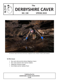
• The Derbyshire Caver, No. 158

    The latest issue is finally complete and printed

    Subscribers should have received their issue in the post - please let us know if you haven't. For everyone else, the online version is now available for free download:

    Click here for download link

Easier ways to discover new cave passages!!!

Hi Andymorgan

I think that the problem with using radio waves is that they travel at the speed of light and so picking up the different times for travelling through rock as opposed to air would be difficult. A friend of mine is going to contact someone who is currently at the Camborne School of Mining as ask him for advise. I don't think that the land owner where we are digging would permit drilling rigs. The camera idea appeals to me however is difficult to estimate the size of passages from a camera – but we have just lost the air space we were following.
 
Hi Hughie

I think we may have met. It is my dream to take a giant digger to the top of Axbridge Hill but I think the landowner would be quite unhappy with us dumping tons of spoil. If this was possible I am sure that 5 years of digging effort could be achieved in just a few hours. Do you have any details of the SMCC methods that are being used at Gibbets Brow? I have visited you “favoured site” and the excavation is 120feet deep. Would the project have started if you used a Scientific method that told you chambers are 150ft below?
 
Hi Pitlamp

Could not agree more with you – I have spent months researching our latest dig – Somerset Archives who hold interviews of the old miners and mining records, club Journals, old OS Maps, Aerial Photographs – if you wish to view my article on the search for the Lost Cave of Axbridge go to this link -

http://www.axbridgecavinggroup.org/group_documentation/journal/acg_journal_april_2005/page_24.htm
 
Hi CUCC Paul

I will be getting in contact with a friend who has a PhD in Geology and pose these questions to him – better still I might be able to get a reply in this forum. Do I deduce that you have been studying the interpretation of seismic results taking in limestone?
 
A

andymorgan

Guest
axbridgecaver said:
I think that the problem with using radio waves is that they travel at the speed of light and so picking up the different times for travelling through rock as opposed to air would be difficult.
That's along the lines I was thinking. I don't think there would be much difference if any.

axbridgecaver said:
Do you have any details of the SMCC methods that are being used at Gibbets Brow?

I'm not Hugie, but I think Shepton have used the resistivity method like Palmer used in the 1960's around Lamb Leer. I can't be too sure of this as the conversation with them took place after many beers. If Hugie doesn't know I'll ask next when I meet some of them.

Andy F

I would agree with you about Llangattock, but like I say it is ultimately about geology of the area to what makes a promising site. The millstone top surface is not permeable to water and any collapse of it which isn't drafting is likely to be 'just a collapse'. Wheras any depression in the Mendips is immediately opened up with a excavator as a depression usually indicates slumping of mud into a passage.
Don't know if that makes sense :?
 
C

cucc Paul

Guest
we were specifically looking for kymerage clay but when you look at the print outs you can see all the cracks in the limestone above this band... if your looking for a cave i would have thought a big crack ie big relflection would be more likely to be a cave than a small reflection.... and if your already suspicous of there being a way on... your geology phd will tell you more im a marine geographer more used to sonar work
 
A

andymorgan

Guest
Sorry Hughie, I used to have a vowel problem but now I am just consonant-pated.

So was is resistivity the Shepton used?

Has anyone taken a dog or rabbit digging with them? They would be useful for shifting compacted mud!
 
C

cucc Paul

Guest
One of our members dogs has been on some trips with us but not digging
 
Some people from the old Goughs diggers in the early nineties may remember the late lamented Rags, who could retrieve things thrown in the total darkness and would squeeze up to you at the dig face and share the dead badger he'd recently rolled in!
 
D

Dave H

Guest
A bit late onto this topic, but here goes.

Templeton: look at picture B - I hope that the dig is not a huge U tube that comes out in the depression just over the hedge!

In OFD they drilled and inserted a camera into cave passage. They dropped in ping-pong balls to get an impression of scale.

Dowsing can local physical differences underground, but:
not everyone can do it
most people can only devine one type of event (water, metal, disturbance)
it takes years of experience to correctly interpret the results
I don't know anyone under 70 who can do it properly

I was 'taught' by someone who was employed by Anglian Water for his dowsing skill. He was sensitive to water and could identify the depth, volume of flow and direction of flow of underground water courses. I unfortunately can only just identify disturbance (enough to follow land drains across permanent pasture fields).
 

Hughie

Active member
Templeton: look at picture B - I hope that the dig is not a huge U tube that comes out in the depression just over the hedge!

After 5 years and 320+ digging trips, I hope not!!!!
 

Mark

Well-known member
chriscastle46 said:
A method I would like to try is Ground Penetrating Radar,

We have been searching for a lost series of tunnels under Dover castle for the last five years, they were abandoned during the second world war and although there are surveys and photographs they are very elusive. We have taken ground penetrating radar in the existing tunnels on several occasions, and the results were quite encouraging at first, trial drilling into the biggest "void" approx 10mtrs x 5mtrs x 5mtrs found nothing (this was after drilling 23mtrs), after drilling several more holes in the general direction, we decided that as the company who deciphers all the data (series of squiggly lines) had seen the original surveys, they were just making things fit.

Dont waste your time its very expensive and a pure dark art

p.s found loads of other stuff under Dover castle in our search
 

biffa

New member
A couple of SWCC members have been buggering about with a resistivity kit. They have found sites where the resistivity shows passages and have started digging. Presumably time will tell.......
 
A

Antony B

Guest
Bit late into this discussion but i might be able to provide an insight into the "pure dark art" of geophysics. If you are looking for some information on the subject then you can refer to some case studies and publications found on www.terradat.com.

I and other shepton members have been carrying out an ongoing geophysical survey over at lamb leer to try and establish whether Palmers chamber really exists, and if it is how we are going to get into it. At the moment we have carried out a couple of resistivity profiles and a gravity survey. The resistivity surveys have located numerous anomalies around the 15m below ground level that may represent voids, however we have only been getting down to a depth of 30-40m at present and we don't really have sufficient data as yet.

Going back to the previous discussions, seismics is not really going to locate airfilled voids if you're using the standard reflection or refraction techniques. You could map the floor of the chamber, however you'll probably not be able to get a sufficiently long survey line out as you're constained by the chamber. Ground penetrating radar would probably do the job and has been used in gaping ghyll main chamber with some success, though you would end up mapping the base of the chamber.
 

AndyF

New member
Antony B said:
..At the moment we have carried out a couple of resistivity profiles and a gravity survey. The resistivity surveys have located numerous anomalies around the 15m below ground level that may represent voids, however we have only been getting down to a depth of 30-40m at present and we don't really have sufficient data as yet.

I believe resistivity is just not going to give you a useful answer. At the end of the day it is purely function of resistance between two points very close to the surface, and no valid information regarding the depth of a feature can be obtained from it. Since resistance decreases with moisture and ionic content, the values from near the surface (where there is damp soil, clay, fertilizer, acid rainwater etc. etc. will totally dominate any results from even a few meters down. If there is bedrock below the surface then the contribution of conduction from these layers will be lost in the noise from surface layers.

It's good for things like filled ditches on archeaological sites, and leaking water pipes etc, but not really any use in this context. - sorry :(

I'm open to being convinced otherwise on this though, how about posting up some results for us to see, ones indicating these anomolies (now there's a challenge from the sceptics corner..)
 

graham

New member
AndyF said:
Antony B said:
..At the moment we have carried out a couple of resistivity profiles and a gravity survey. The resistivity surveys have located numerous anomalies around the 15m below ground level that may represent voids, however we have only been getting down to a depth of 30-40m at present and we don't really have sufficient data as yet.

I believe resistivity is just not going to give you a useful answer. At the end of the day it is purely function of resistance between two points very close to the surface, and no valid information regarding the depth of a feature can be obtained from it. Since resistance decreases with moisture and ionic content, the values from near the surface (where there is damp soil, clay, fertilizer, acid rainwater etc. etc. will totally dominate any results from even a few meters down. If there is bedrock below the surface then the contribution of conduction from these layers will be lost in the noise from surface layers.

It's good for things like filled ditches on archeaological sites, and leaking water pipes etc, but not really any use in this context. - sorry :(

I'm open to being convinced otherwise on this though, how about posting up some results for us to see, ones indicating these anomolies (now there's a challenge from the sceptics corner..)


Agreed. There was a complete debunking of this by J.O. Myers in Cave Science (Vol 2 (4) pp 167 - 172) in 1975. The article is entitled Cave Location by Electrical Resistivity measurements: some misconceptions and the practical limits of detection
 
Top