

You are using an out of date browser. It may not display this or other websites correctly.
You should upgrade or use an alternative browser.
You should upgrade or use an alternative browser.
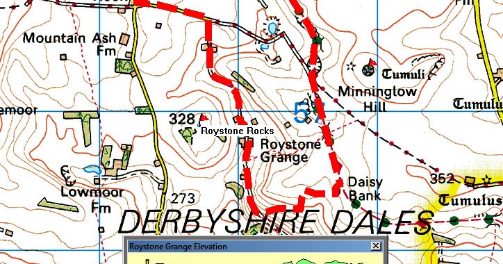
Roystone Grange.
- Thread starter Dunna55
- Start date
Photo here (& says they went in it before it was sealed):
 explorerjims.blogspot.com
Documents from the quarry (Also mentions "Mill Close Lead Mine in Wensley"):
Roystone Grange in the Mist
$ of us this week and we headed up towards Via Gellia which was unfortunately closed so we had to divert through Middleton and Longstone to ...
explorerjims.blogspot.com
You can also see traces of lead mining on the opposite hillside (as hollows in the ground). Peak District lead was a great attraction to the Romans.
Documents from the quarry (Also mentions "Mill Close Lead Mine in Wensley"):
Last edited:
pwhole
Well-known member
I remember your report now - it does sound like an odd one, and more like someone's pet project than a serious commercial enterprise, given the lack of useful minerals. Perhaps it was merely done for practice/training?
And we can always add sites like these to the Cave Registry if folks want them in - the email address to use is on the DCA website.
And we can always add sites like these to the Cave Registry if folks want them in - the email address to use is on the DCA website.
speleokitty3
New member
Hi Phil
There was quite a lot of local activity mining for calcite in the 20th century (surface and underground) - Long Rake, Arbour Low, Moss Rake, Cromford Moor Mine, Chelmorton (can't remember the name of the mine) and others. It was used as a decorative dressing, in terrazzo floors and even as chicken grit. Other minerals (especially galena) were considered problematic contaminants.
There was quite a lot of local activity mining for calcite in the 20th century (surface and underground) - Long Rake, Arbour Low, Moss Rake, Cromford Moor Mine, Chelmorton (can't remember the name of the mine) and others. It was used as a decorative dressing, in terrazzo floors and even as chicken grit. Other minerals (especially galena) were considered problematic contaminants.
AR
Well-known member
I don't know if it had an "official" name or was ever registered with the Barmaster, I called it Royston Grange adit when I wrote it up - text below.
Above an obvious rock-cut loading bay and in the line of trialling hillocks on a vein, there is a small adit entrance. This leads into a stooping height passage, with a small area stoped above just inside and some deads supported on old rails and timbers. The level continues for some distance along the line of a scrin until it reaches a four-way junction, with two passages quickly stopping at forefields to the left and straight on. The passage to the right carries on for some distance to a forefield, and just before this a short blind branch passage runs off to the left.
The mine appears to have been driven in the 20th century and there is a date of 1953 and some initials scratched into the wall. It was apparently an attempt to mine calcite since no galena or other minerals were noted, but the veins are quite small and unlikely to have produced viable amounts of anything. Hooks driven into the wall appear to have been for supporting an air line, and there are some remaining pieces of heavy-duty hose which were probably used for this purpose. There is also a strange metal contraption near to the entrance which Terry Worthington (pers.comm) has identified as a home-made support for a compressed air drill. There are faint impressions of rails still visible on the level floor and Terry reports that these rails were removed for use at Goodluck mine in the 1970s.
History Trog
Member
I am not familiar with this area but can supply a few notes and perhaps AR or someone else who has visited the area might be able to identify the mines involved and lay out the courses of the veins.
In the barmasters’ books, Royston Grange was called Ryestone Farm, and was the location of the following mines. Some were perhaps worked mainly for minerals other than lead ore as hardly any output was recorded.
______________________
Red Vein
Book 24 p60
1814 Nov 28 George Taylor and Jno. Rowbotham given an old founder called Red Vein in Ryestone Farm – founder meer with 1 meer E and 14 meers W.
[This sounds like an iron ore vein rather than a calcite vein.]
Staffords Dream Mine
Book 25 No. 10
22 Nov 1822 George Stafford of Carsington given an old mine that he calls Staffords Dream Mine in Ryestone Farm “near to the gate at the End of the Lane going down for Mining Lowe House” with 7 meers E and 5 meers SE from the lower end and 5 meers SE from the pee.
Book 25 No. 81
16 Mar 1831 George Buxton Tissington given Staffords Dream Mine, similar to above.
[George Buxton Tissington was a well-known mine agent who had worked Hard Rake Mine at High Tor, Matlock, and had acted for the Derbyshire Mining Association. By 1831, he was in serious financial difficulties.]
Pipers Inn Mine
Various refs to this, a few below. It was given to several non-local speculators so it must have had unusually promising features.
1804 given away as Pipers Scrin Mine.
Book 25 No. 75
26 May 1830 George Buxton Tissington given Pipers Inn Old Title, being part in Mining Low Farm and part in Thomas Brown’s Farm [the Tithe Farm] , with 3 meers E and 21 meers W “down to the lane end near Mininglowe Meer.
In 1810, given away as 12 meers W from the Duke of Rutlands Walk & in to Mining Low Farm.
1817 given to Mr. Storer of Lockington “at the Top of Mininglow Farm”.
_______________________
My calendar to the Barmaster’s Collection at Chatsworth includes the following refs:
103/52 Letter from Bamford and Son of Ashbourne, solicitors. 29 September 1911. Mr. Hall of Overseal wants you to post notices of forfeiture on the mine at Royston Rocks (in Brassington Liberty). We believe it was last worked many years ago by the late William Johnson.
This relates to General Wolfe Mine:
103/76. Notice to William Allsebrook of Burton-on-Trent, botanist, that unless his mine called General Wolfe near Parwich in Brassington Liberty is put into workmanship within three weeks, it will be given away. 13 October 1911.
77. Notice that General Wolfe Mine near Parwich in Brassington Liberty will be given away unless put into workmanship within three weeks. 13 October 1911.
Book 10 p34
1 March 1876 After notice given to Edward Daniel and Henry Gimbert, both of Cheadle, gave William Johnson of Parwich, farmer, General Wolfe Mine near Low Moor in Ballidon Parish in land occupied by Mr. Bunting of Royston Grange.
Its founder at an Engine Shaft in Grange Back Field by the lane from Parwich to Pike Hall with 9 meers E to the top of Royston Rocks and 3 meers W to the highway from Parwich to Pike Hall.
[Having owners from Cheadle might imply that it yielded calamine.]
AR
Well-known member
Having a look around the area on lidar, I think General Wolfe Mine will be on the vein with obvious hillocks running up Royston Rocks, the marker is on the lane from Pikehall to Parwich looking south. Not so sure about the others, though Red Vein does sound like a possible for the mine this thread is about if you were to take the lane running south from Roystone Grange as the end of the title, it'b be about a meer to the adit entrance and the vein continues westwards?

History Trog
Member
Have been off-line over the weekend as am still using the local library for Internet access.
I have discovered a bit about Red Vein. Farey’s list of mines in 1811 (Volume 1 p265) included:
Red-mineral, S of Newhaven-House, in Hartington, in 4th Lime, red Iron Ore ? pretended Cinibar.
There is no other appropriately named vein in this area and it seems probable that this Red Mineral Mine is Red Vein Mine. This alleged occurrence is mentioned in Trevor Ford’s article Minerals of Derbyshire (PDMHS Bull Vol. 12 No. 1) under Cinnabar but he evidently did not know its location. Only minute traces of cinnabar have been properly identified in Derbyshire – in Nestus Pipes at Matlock and at Magpie Mine, Sheldon.
The background to this is provided by Jim Rieuwerts in Vol. 3 of his master work, p17 where he details how Josiah Holdship attempted to defraud various wealthy people and the Government during 1805-15 claiming to have found large amounts of silver, mercury, etc at several mines at Elton and Middleton-by-Youlgreave (but Jim does not cover their activities in the other liberties). A smelting works for mercury was supposed to have been built in Bonsall.
Two Elton miners, Emanuel Gollin and George Bridge, co-operated with Holdship. The gift of Piperscrin on 15 Aug 1804 was to “Eml. Golwin of Elton for the use of Mr. Hadley of Derby”, a wealthy gentleman, so there was some sort of con going on there as well. On 28 May 1810 Golwin took Pipers Inn for himself and partners. On 27 Nov 1811 Pipers Inn Title was viewed for Ralph Blore who was one of the partners in the mercury smelting concern at Bonsall.
On 26 June 1814, Pipers Inn Title was given to William Tommison of Matlock who had a colour works at Bonsall, so that may explain his interest here. On 16 Oct 1817 it was given to Mr. Storer of Lockington in Leicestershire, a wealthy gentleman. Then on 7 Feb 1824, it was given to Francis Staley of Elton.
There is much more to mining history than just listing ore production statistics. Off-beat stories such as the above always appeal to me. Around Minning Low, it was not only the sheep that were getting fleeced.
It would be useful if anyone ever exploring these mines could find out exactly what red minerals do occur.
The British Geological Survey website maps portal
has a vast array of geological maps free to view. A 10,560 scale one for the Parwich area is available as below and shows the Roystone Rocks area half way up the right hand side, marking a vein there and the Mininglow Fault etc.
https://largeimages.bgs.ac.uk/iip/mapsportal.html?id=13588448
pwhole
Well-known member
Hmm, this vaguely reminds me now of a PDMHS evening trip we did to a lead mine near Kniveton some years ago, that had some 'red mineral' in it, and I remember climbing up into the roof of a stope to pull out a lump of extremely corroded galena from a vein in the roof - looked like it had been attacked by a strong acid, with a very pitted surface - I still have it. I wonder if the red is related? I'm hoping AR might be able to fill me in a bit on the details!
AR
Well-known member
I think I know what the red mineral will be if it's in the Newhaven area - Duke's Red Marble, which is a recrystallised limestone stained red by close contact with Hematite. Although most modern sources say it came from Alport (including TDF), that's a mistake perpetuated from an early 20th century account. In actual fact, Duke's Red was discovered when Newhaven House (the old coaching inn) was built, and the vein it occurred in ran under the road to the east; it was removed by the 20th century sandpits. A similar deposit occurred at Alsop Moor and was tried for ironstone in the early 20th century but the iron content was too low. There does seem to be some relationship between the sand deposits, the Hematite, and these recrystallised limestone deposits but I'll leave that to a geologist to figure out!
I wasn't on the Kniveton trip in question so I can't comment on that but I guess if there are/were iron minerals present, particularly Marcasite, then forming acids through groundwater contact is a possibility?
I wasn't on the Kniveton trip in question so I can't comment on that but I guess if there are/were iron minerals present, particularly Marcasite, then forming acids through groundwater contact is a possibility?
pwhole
Well-known member
Hopefully someone else who was on the trip can remind me - it wasn't a very well-known site, I do remember that. And that there was another level next to the mine we entered that had specifically mined the red mineral, and I suspect it was hematite now.
But I found a photo of the galena lump - I'm glad I'm a nerd sometimes. It's about 8cm long. It was twice the size when I pulled it out, but we broke it in half to give a piece to the landowner, who'd never seen any. Not a typical example though, with smooth rock-looking surfaces and pitted eroded ones alongside. The red staining is part of the other deposit, I believe.

But I found a photo of the galena lump - I'm glad I'm a nerd sometimes. It's about 8cm long. It was twice the size when I pulled it out, but we broke it in half to give a piece to the landowner, who'd never seen any. Not a typical example though, with smooth rock-looking surfaces and pitted eroded ones alongside. The red staining is part of the other deposit, I believe.
