You are using an out of date browser. It may not display this or other websites correctly.
You should upgrade or use an alternative browser.
You should upgrade or use an alternative browser.
Yordas area question
- Thread starter Badlad
- Start date
Jim MacPherson
Member
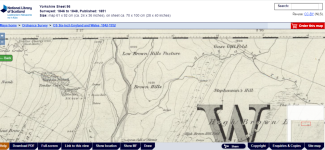
Just to be of little benefit, there is no evidence of dams on the 1851 25 inch OS map and the early surveyors were fairly punctilious about recording things (but it does say the quarry was producing "black marble" so might be a pretty exposure of dark limestone), nothing of the 1907 version and nothing on the current OS mapping.
Jim
Jim
Attachments
That's a great image alanw, shows them perfectly. The 'ditches', 'trackways', whatever they are do not look natural one bit.
What with the dams above they sort of look like an attempt to divert water away from the cave. Could it have been something those Victorians got up to?
What with the dams above they sort of look like an attempt to divert water away from the cave. Could it have been something those Victorians got up to?
shotlighter
Active member
I was wondering if it was something to do with when it was a showcave?That's a great image alanw, shows them perfectly. The 'ditches', 'trackways', whatever they are do not look natural one bit.
What with the dams above they sort of look like an attempt to divert water away from the cave. Could it have been something those Victorians got up to?
langcliffe
Well-known member
Unlikely. Yordas show cave was a very low-key enterprise, with only the occasional visitor (although it did have some very eminent ones including Wordsworth and Turner).I was wondering if it was something to do with when it was a showcave?
In 1890 Balderstone records knocking on the door of Braida Garth, crossing the chap's palm with a florin, and being taken in through the locked entrance door with some candles.
Are the metal rods sticking up from the dam identifiably rebar (spiral or chevron patterns on the surface) or plain? Reinforced concrete was developed during Victorian times but what we now think of as rebar didn't appear until the 1930s. I can't think what the purpose of those rods would be.Could it have been something those Victorians got up to?
Jim MacPherson
Member
Just because I've done some of the garden's grass cutting and somewhat hot and bothered (sun and no rain), a bit about the quarry and it's black marble, nothing about the geology, maybe akin to Frosterley Marble, perhaps a passing geologist might know?
Doesn't explain the dams or the reinforcing metal bits, as speculating's always fun from the photo they do seem be of a nearly uniform height above and angle to the concrete dam wall face.
Jim
Doesn't explain the dams or the reinforcing metal bits, as speculating's always fun from the photo they do seem be of a nearly uniform height above and angle to the concrete dam wall face.
Jim


