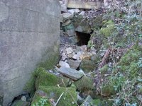
The photo of the riverside level is in fact of the Cawdor Shaft pumpway. If only it could have been followed up to the engine shaft, it would have been most interesting to discover its exact location and present state, which is a mystery despite the proximity of the new road for the Cawdor Quarry development scheme and the Sainsbury Supermarket. However, the precarious hanging stone obviously discourages reasonable exploration.
I use the local library for internet access, which makes my responses so slow as to be pretty well useless. Anyway, below are some extracts from my forthcoming (?) book:
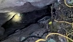
Cawdor Level tail had been destroyed by 1978 ?but a very powerful flow of water issues into the Derwent in wet weather? at 30 litres per second (Oakman, Colin, 1979. The Sough Hydrology of the Wirksworth-Matlock-Youlgreave area. M. Phil. thesis. Leicester University).
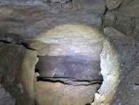
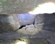
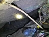
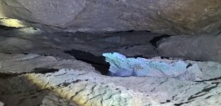
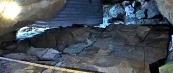
Slightly west of Cawdor Level tail is a dry sough-like passage, apparently a nineteenth-century pumpway from Cawdor Shaft. A partial blockage about 20 feet in prevents progress but the level continues beyond. (Willies, Lynn, 2005. Cawdor Sough, Matlock ? A Failed Exploration Attempt. P.D.M.H.S. Newsletter No 115 pp5-6.) It has a flat slabbed roof, and it opens up to four feet high after a short distance.


")