• CSCC Newsletter - May 2024

    Available now. Includes details of upcoming CSCC Annual General Meeting 10th May 2024

    Click here for more info

Coniston Cold

Skyrmy

Member
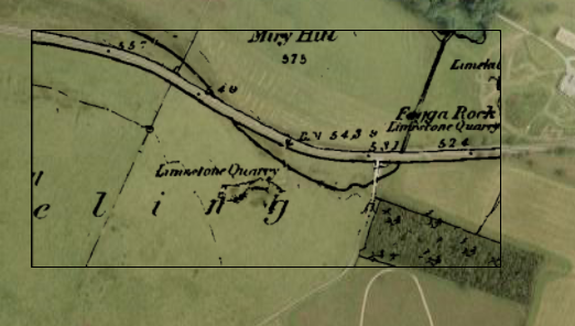
Driving back from Bradford (A65) earlier in the week I noticed a large shakehole/collapse in a field on the lefthand side of the road (just as the road swings right immediately after the Hotel on the right) just north of Coniston Cold.

Anyone know if there is anything there??  Didn't have time to sop and scrat unfotunately!
 

ChrisJC

Well-known member
The feature has been there since the early 90's at least. And it's been intriguing me for that long.....


Chris.
 

Skyrmy

Member
Certainly looks like it has collapsed into something big by the size of it!

Looking on google earth, there appears to be a little stream/trickle either from it or into it - difficult to resolve the close up.


footleg

New member
I've also wondered at what might lie below there every time I drive up that way. I've always thought that is some sort of mine entrance, and not actually on the limestone there. Anyone actually investigated?
 

RobinGriffiths

Well-known member
Marked as a disused quarry on 1:25,000 OS Maps. It appears to be in the Yoredale series. I suppose there are several possible things that could have been extracted depending on thickness and quality of the bed: fireclay, gannister (as refractory material), limestone, limestone and shale  (for cement), sandstone or coal.
 

braveduck

Active member
All round that area is great scar limestone,on the geological map it looks fantastic.Trouble is there is no high ground.
In theory there really should be some caves round there.Many members of the BPC have noticed the hole you refer to,and commented on it for years
but they have allways been passing through and never stopped to have a look!!The Quarry you refer to is in the Conifer wood and was quite easily seen as a quarry in the 1960s before the trees were planted.My guess is the land behind the hotel were it falls down to the Conistone Hall lake would be worth a look for caves.Incidental if you get a clear view across the lake and beyond,it is possable to see Malham Cove.Danger get a passenger to look for you or you may have an accident!!!!!!!
That  whole area would be worth a look but the Coniston Hall estate is all private and is an outdoor pursuits center for the very rich.
People with maps of that area,are there any foot paths?
 

Skyrmy

Member
Rob said:

Yep, thats the one! As you drive past you can just about see (before you have to look back at where you are going) a limestone block.

This thread is becomming intriguing and may be worth a sniff about some time (ahem - with landowners permission of course!!!)
 

knuckledragger

New member
The nearest Limestone is a few miles North of Coniston Cold and is the Southern tip of the Askrigg block marked by the Craven Fault - Malham Cove. Any geologists may note that when driving from Skipton to Settle you pass over a huge area of Drumlins (notice lots of smooth shallow hills when driving) and I suspect this is what we have here. Drumlins contain a massive amount of rocks and clay removed from other areas by glaciers wich were then overridden by the moving ice..

It is possible that there is a very large chunk of limestone deposited there which has been quarried in the past but generally speaking the local area is on gritstone and there are no caves in this location.

I will stop and have a closer look next time I pass as I know the landowner (I sold tractors for many years at Hellifield just a mile away). Incidentally, each time ive looked at it from the road i thought it was a landslip or quarry  :-\

Hmm..
 

Les W

Active member
knuckledragger said:
The nearest Limestone is a few miles North of Coniston Cold and is the Southern tip of the Askrigg block marked by the Craven Fault - Malham Cove.

A substantial number of Mendip Caves have been found nowhere near Limestone.  ;)
 

braveduck

Active member
There are lots of drumlins further north but if you take the trouble to look at a geological map ,Coniston Cold sit on solid Limestone,not transported.
The hole of interest which sparked this thread is at the base of a drumlin but the shakehole itself is in solid limestone.
If you look at the other side of the road you will see small hills of solid limestone(where the4x4s play).
Please do look at a geological map before making statements about lack of solid limestone.
Caves are where you find them!!!!
 
T

Tartan Amy

Guest
Ah - geological maps.  I'm not disagreeing with you braveduck, and I don't have the relevant sheets to hand.  Trouble is, the BGS make 2 types of map - solid and drift.  The solid edition shows the "solid" geology ie preglacial stratigraphy, but the drift editions includes the glacial material sitting on top.  So one map could show "solid" limestone and the other eg. a drumlin field, both at the same location. 
 
RobinGriffiths said:
The 1853 1:10,560 map at http://www.old-maps.co.uk/ marks it as 'Limestone Quarry'.

conistonoverlay.png
 
RobinGriffiths said:
The 1853 1:10,560 map at http://www.old-maps.co.uk/ marks it as 'Limestone Quarry'.

.. not sure why the image in the last post didn't work. Try this link:

http://cavemaps.50webs.com/extras/conistonoverlay.png
 
Top