If we are talking possible sites have you considered the Tamar Valley. Arguably the discovery of the Roman fort at Calstock in 2006 opens up that possibility.
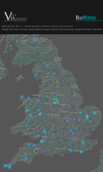
I can't seem to be able to get any information from the map. I can zoom in but all I see are blue dots.
I zoomed into the ones in the Forest of Dean. 2 seem to be in the village of Aylburton. I know there is a mine roughly where one dot is but I don't think it is Roman. However in Lydney Park a few hundred yards away there is an iron mine underneath the Roman temple of Nodens which is missing from the map.
Hello am very interested I have some local to me around Northamptonshire but when I zoom in to the blue dots I am afraid it does not let me see a name for the place ?
Hello am very interested I have some local to me around Northamptonshire but when I zoom in to the blue dots I am afraid it does not let me see a name for the place ?
edit - the other possibility (if the map is a bit off) is the Chee Tor settlement, where there was possible but not conclusive evidence of lead smelting
I've spotted a blue somewhere and I'm keen to click on it to learn more. Hopefully this'll work soon when gingernutcrazy has had time to develop it more
I'm not sure how accurrate any of this is.
eg The line of the 720a (Manchester to Ilkley) on Romine seems very very different from accepted lines. (certainly the track past Keighley)