Pitlamp
Well-known member
Here's one to exercise your grey matter (no pun intended) whilst we're all grounded during the coronavivus lockdown.
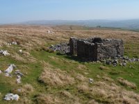
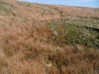
Grey wife Sike (a small stream west of Cote Gill) was artificially channelled in the past, to avoid it sinking in various shakeholes where it meets the Great Scar Limestone at the foot of the Yoredale Series. Presumably this was to provide a water supply further down the hill. But the channel was deliberately curved to take the water to a large blocked shakehole at about SD73257125. (This is clearly shown on the 1:25,000 O.S. map.)
Close to the final quarter of a mile or so of this disused water course is a line of well built shooting butts but no obvious signs of any former building. So why was all the effort made to channel the water to a shakehole? Did there used to be a shooting hut there, of which there's now no remains? Or was the shakehole in question known to drain to a spring further down the hill which supplied one of the farms?
I've always wondered about this one; can anyone shed any light on it?


