Leclused
Active member
Hello,
I just want to start up this thread to create some awerness about conservation practices.
Some background :
The following pictures are all taken in a cave that we (several Belgian Clubs) are exploring in the Haute Marne/ Haute Saone region. The cave is called Rigotte.
Conservation is done directly after the first exploration of the cave. Where required a path is marked with poles and fencing tape. Pictograms are placed to inform other caves how to behave from a specific point. In the case of photo 1 the first part is marked with poles and fencing poles. But the rest of the part is markt with small cones. These are removeable.
Photos all taken by Geert de Sadelaer (Sc Cascade)
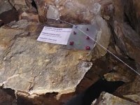
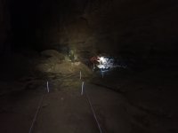
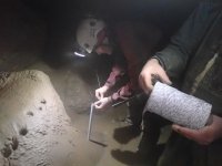