Filling in of Shakeholes behind Hillhead Quarry

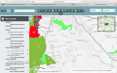
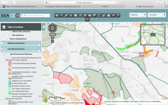
Quite a few of the large shakeholes have been filled in on the Moor behind Hillhead Quarry at 064695. I've got a few photos for reference. Is this actually allowed? Some of these were a fair old size and will now be gone forever.....
 

Badlad

Administrator
Staff member
One factor would be the designation of the land there. AONB, SSSI, NNR, etc. Check with the local natural England rep.
 

pwhole

Well-known member
Doesn't look like there are SSSIs there. Select the menus at left:

https://magic.defra.gov.uk/MagicMap.aspx

1675362867319.png
 

Mr Dinwiddy

Member
PWHole beat me to this but there are non-SSSI options below....

I don't think this is within a SSSI. The quickest way to check is the Defra Magic GIS website. https://magic.defra.gov.uk/MagicMap.aspx
Screenshot of this attached- you open the Designations tab on the left hand side of the screen, then checkbox the land based designations, then statutory designations and SSSI units to refine your search. Lots of good info on this site. It also looks like its outside the National Park boundary. Thats going to restrict who you can ask for help.

You can also use Magic to see whether the land is within an agri-environment scheme. The taxpayer is paying for environmental outcomes in that case so there is a good chance that one of those schemes would prevent infilling of shake holes. The second screenshot here shows those schemes. There is a little info button on the top menu this will tell you the name of the agreement holder and how much public money he gets paid.

That feature is very useful if you want to find a landowner (though it will generally be a tenant or the farmer who has the agreement)

Back to the shake holes- if its in a scheme you could ask Natural England whether filing of shake holes was permitted within the scheme. If not you could ask them to do something about it.
 

Attachments

  • Screenshot 2023-02-02 at 18.16.20.png
    Screenshot 2023-02-02 at 18.16.20.png
    441.7 KB · Views: 73
  • Screenshot 2023-02-02 at 18.30.50.png
    Screenshot 2023-02-02 at 18.30.50.png
    639.7 KB · Views: 70
Not all the 'holes' up there are natural shake holes, there are a LOT of bomb craters (the whole area has been used for storing, testing and disposing of things that go bang since WWII).
There are also a number of lime burning pudding pie kilns too.
 
Top