More questions on Bradwell Catchment

pwhole

Well-known member
Here's the Blue Bell shaft top, with the Raddlepits hillocks in the background. Sorry about the copyright stamp, but I managed to delete my original RAW file, and it's the only copy I have left. Rob has a nice one of it in snow with a big melty bit to one side, as I remember.

_IGP0083_sm.jpg


Also the two Rake Head shafts, again with Raddlepits in the background. This is roughly the angle I believe the old 1867 shot was taken, but around the hillock in the middle distance, not this one, which seemed defunct as a working site by then.

_IGP9251_sm.jpg
 

T pot 2

Active member
Perusing the Barmasters Book Bradwell 1826 - 1845 I came across this recording.

Hundred of High Peak and Liberty of Queensfield. March 22 1843.
Robert and Thomas Middleton gives to Jonathan Howe, Barmaster, one dish of ore to free a founder meer in an old pipe vein lying on the north side Raddlepits Mine and on the south side Brunt Mine in the Liberty of Bradwell and called it Blue Bell.


Hundred of the High Peak and the Queensfield 2nd May 1843. Robert and Thomas Middleton gives to Jonathan How, Barmaster one dish of ore to free a taker meer from Blue Bell Founder in in a northwesterdly direction being on the North side Brunt Mine in the Liberty of Bradwell.

John Bradwell.

This may answer how Raddle Pits and Blue Bell were connected

T pot
 

pwhole

Well-known member
That's the one - Jim dug it out for me a while a go. I believe there may be another entry about the jurymen visiting to inspect it, as the Middletons were clearly having a bit of a fiddle. When Puttrell and friends descended Brunt in 1907, they followed the same pipe toward Raddlepits, but were stopped by a collapse not far along. Intriguingly, the Brunt shaft was nowhere near as deep as Raddlepits, so if the pipe you followed was accessed via the natural chamber below the bottom cartgate (at least 120m down), there's a considerable distance to make up. Unless you went off the loop on the east side from the 70m (kibble) level?

I think Thomas Middleton was killed shortly after this happened. I've also found 'RM' smoked on the roof of a very high stope in there, presumably done when it wasn't very high!
 

T pot 2

Active member
Phil
Is the loop that you refer to the level that wraps around the shaft but doesn't connect with it ?

T pot
 

Big Jim

Member
With Regard to the boulder capped shaft in the photo (Rake Head / Hugh Grove). That's the one Eavis n myself 'bottomed' a few years ago. No sign of the wooden platform the T talks off though.  At approx. -80m the shaft hits a clay/tufa wayboard and opens out. On one side there is a mined level that a large volume of water issues from (and descends the narrower continuation of the main shaft). The mined level zig-zags for a short distance with a couple of 'ways on' blocked by deads and ends at a forefield from where the water emits at foot level from beneath and in-situ boulder. The level did continue left at this point but was again packed with deads. We cleared a few and found a small draughting phreatic (too small to enter) on the right hand wall of this crawling height level.  Returning to the main shaft there were further workings slightly bellow and opposite the level just described that we managed to bolt across to. No obvious ways on but several possible routes blocked by collapses.

The water pours down the narrower main shaft for approx. 30-40m. It was very wet when we descended despite a prolonged period of drought, so I can imagine what it would be like under normal conditions and hence why T and Dan H never descend further. The shaft pops out into a chamber ?part natural with several ways on.  The water runs off into a bedding plane about 2ft high that Rob explored but could find no way on (it was only a quick butchers) but all that water must go somewhere.....  Also from this chamber was a climbing shaft heading upwards with wooden stemples in-situ (not explored) and a couple other routes on. We looked down one that was rather loose before heading back to surface. The lower section of the main shaft being a bit scarey (breathing wasn't easy with all that water coming down on us!!!).

Rob E did a rough sketch (not survey) of what we explored. Sadly permission for further access was denied by thelandowner- Mr Hadfield. That was about 5 years ago so maybe worth another approach to Hadfield as the place really needs looking at...... With all that water flowing through, die testing could be interesting........... (y)
 

pwhole

Well-known member
Is the loop that you refer to the level that wraps around the shaft but doesn't connect with it ?

Yeah, it's a short climb up from the striking floor, under the stempled climbing shaft that goes back up to the 50m landing, and then head right at the fork, and under the horrible collapsed bit into further cartgates, some arched and some cut out of a pipe? I have a survey of it from Alan M, titled '240ft Leve'l. It's a closed loop with a branch off to the NE that leads to 'Safety Pin Shaft'? Though it doesn't wrap around the shaft, but stays entirely to the east of it.

Jim, I do seem to remember that the reply you received from Mr. Hadfield specifically objected to 'recreational caving'. I still wonder whether a combined approach by PDMHS, BCRA and DCA, with an emphasis on historical investigation and speleological/(hydro)geological research might pay more dividends? There's absolutely no issues with 'bad air' or any other hazard around there, and I'm sure it was the liability he was primarily concerned with. If the insurance issues can be explained by a more 'reputable organisation' than ourselves, there could be a chance he might change his mind. After all, his land may need all the protection it can get from underground explorers in the future.
 

Big Jim

Member
Phil, I cant find his letter right now but seem to recall that his declining access was down to advice from his lawyers and didn't really mention 'recreational caving'. In fact in the approach to him we made no mention of recreational caving and focused more on the surveying the mine for its historical value and also ecological value (specifically bats).  We also pointed out (in writing) that the DCA could provide landowner liability cover for free (as they do at Bagshawe). This was all over 5 years ago now so another approach to Hadfield by PDMHS/DCA could be worth a shot.....
 

pwhole

Well-known member
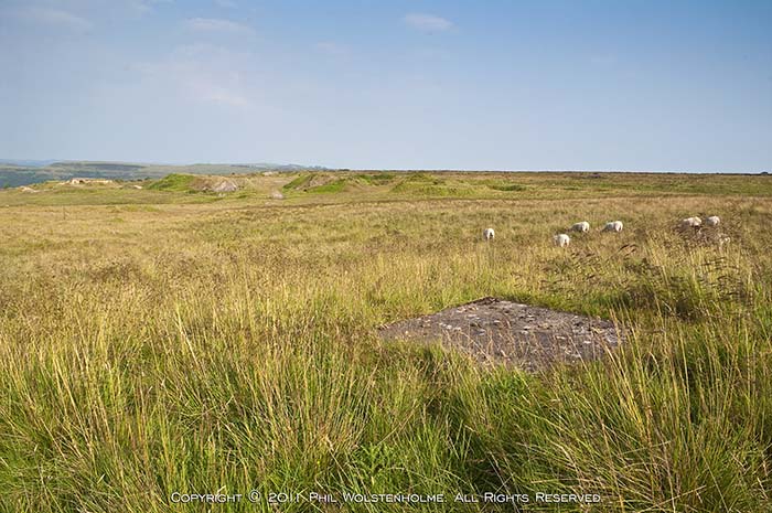
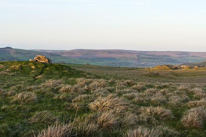
Even if the 'reputable organisation' controlled access (via a collected key system, similar to other venues), it would be a vast improvement on the present situation. Documenting those mine workings is of huge national importance, especially with the possible changes to monument scheduling to include sites that are generally not accessible by the general public (like shipwrecks), but are very important nevertheless, and obtain protection. As far as I know, all the mineral rights beyond Raddlepits are owned by the Duchy, so no further opencasting or mining should ever take place, at least along the vein. The famer has a perfect right to be concerned about his land and his livestock, but if it's managed well and folks respected the arrangement (a big if), you never know.
 

T pot 2

Active member
A few posts ago I mentioned that I was willing to set up a sort of Bradda Moor symposium in order for those interested to share their information with other parties with the same goals. It could be on a Sat / Sunday or even midweek on an evening that suits. Any time after the 12th of March would be good, please mail me if interested and it will be arranged.

T pot
 

SamT

Moderator
I'd certainly like to be involved T,  I've not been active in baggers for a couple of years, but still have a very active interest.
 

nickwilliams

Well-known member
Count me in too, T. Depending on how many want to come, you can use my office meeting room, or I can book a room in the Nightingale Centre in Hucklow if you'd like.
 

cavermark

New member
THe symposium could be the place to discuss an access proposal to the boulder capped shaft Jim described. I have a few ideas around what might work there...
 

SamT

Moderator
Lots and lots to discuss.

Dye Testing is defiantly something that needs more finer work done.  John Gunn obviously did various stuff, but I think his detectors were always just placed in the lumb, (for obvious reasons).  But it would be nice to take that and refine it to have detectors within bagshawe at the upstream sumps, glory hole, downstream sumps, resurgence and upstream in a couple of the sough tails.

Is the stream in Long Rake the same as the one in Hugh Grove.

Pretty sure Long Rake will resurge at the one of the soughs under the cement works.
Does Hugh grove resurge here - or out of one of the moss rake soughs.

What about the huge amount of water that sinks at Hartle Dale bottom layby,  Does that come out on one of the moss rake soughs - or does it follow a natural course underneath the dry dale to the glory hole in bagshawe...

So many questions!!!
 

T pot 2

Active member
Caremark, SamT
I am putting together an agenda for the event your ideas will be included. A structure for the symposium is required or we will end up going around in circles and achieve nothing. Let's put all our eggs in one basket and achieve something.

T pot
 

AR

Well-known member
I'd be interested in attending if I can make the chosen date/time. If people want a pub as the venue, the back room of the Anchor is a decent size and they don't charge for it if everyone buys at least one drink.

Sam - I'm not so sure drainage from LR would end up in Kronstadt Sough, given the general trend of the veins?
 

pwhole

Well-known member
I have a feeling Sam may have something there - Long Rake did split into lots of smaller veins before the quarry, and it seems that Kronstadt did pile straight into them? It may be too far to the west though, and take more Dirtlow water generally. We really should take up that invite. I didn't see any evidence of substantial running water in Raddlepits - it's dry as a bone in most places, even from percolation, and right at the bottom too. However, the evidence of substantial running water in ancient times is overwhelming in some of the parts I've seen. I would guess that Rake Head (which was deeper, and penetrated another lava bed) has its own natural drainage system that Raddlepits and all the others nearer Bradwell would have shared. Where it comes out though is anyone's guess at present.

Jim Rieuwerts gave me some great Paul Deakin photos down Rake Head - these were down the slabbed shaft, in the 1970's. I only ever had one telephone conversation with Paul, but I specifically asked him to confirm which shaft it was, and he said it was that one. A photo of an earthenware bowl down there was later backed up by Martyn who said he saw the same bowl on the one descent he did of that.
 
Top