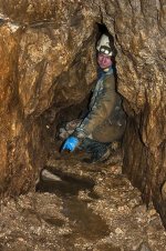
The JH inlet is very interesting, as it's 50m underground, but appears to be flowing upwards, based on our observations - through an admittedly limited exit hole near a choke, which may be distorting the impression of the flow somewhat. But it flows in anything but drought, and is west of Main Rising, so seems to be part of an 'intermediate' water table, possibly prevented from sinking there by the wayboards lower down. I've been to the other side of the choke, and there was no significant water anywhere beyond drips. I wasn't aware of the rising on the farm track, so maybe it's the same water? It's below, ably indicated by young Mr. Gott.
Is it possible that the water near the cement works path is part of Kronstadt Sough? I was told that it fed the fishing lakes now, but they must have an outlet to Peakshole Water. Nunlowend Sough drains to Bradwell Brook I think though, so outside this query's remit. Water sinks into Mam Tor Swallet and comes out in Odin Sough, but I doubt it's a sinking 'stream' in anything other than very wet weather - JG's dye-trace proved the connection. There's also means to be a 'rising' somewhere on Red Seats Vein off the Pindale Road in very wet weather, according to Chris Heathcote, but I've never seen it - presumably it drains unknown stuff in Michill Bank. That hill holds some secrets...