Is it safe to go caving yet? Modelling cave flood events in Yorkshishire

mikem

Well-known member
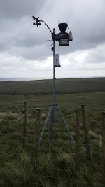
The Centre for Ecology & Hydrology also has an incredibly detailed data set going back a variable number of years. Downstream of High Bentham appears to be the most complete local river. Something to watch out for is that cumecs is not proportionally related to river height:
https://nrfa.ceh.ac.uk/data/station/meanflow/72009

"Peak flow data" lists the highest day in each 12 month period (these are summer to summer, rather than calendar years), & does not include other high levels in same period - you have to check page I linked to for those. If you change "annual maximum data" to "peak flow rating information", you get a chart as to how volume varies with height.
 

Ian P

Administrator
Staff member
The Craven Pothole Club in Horton in Ribblesdale adjoins the river Ribble and also Brants Gill.

If this location was of any use to such a project (river level monitors etc) I am sure the club would be happy to look at anything that would benefit the caving community 

Drop an email to the secretary if there is anything you would like the committee to discuss.

secretary@cravenpotholeclub.org

Ian
 

Chocolate fireguard

Active member
This is a great idea.
For about 20 years I ran research projects at a couple of industrial research organisations.
One of the things I learned was that when you are first trialling an instrument you have built or modified you need to know what the results are going to be. If you don?t you have no idea if any surprises are due to genuine effects or your equipment not behaving as you expect.
I would not use either Peak or Sleets Gill as a first step. So far as I am aware no one (yet) understands how or why they respond to different sources of water, and monitoring those sources would not be straightforward.
In Derbyshire I might go for Giants, perhaps at sump 1. In Yorkshire perhaps Upper Long Churn. Both easily accessible and so far as I know the source of water in each case is obvious and rainfall data is available.
It is quite likely you already knew all this. If so please don?t be offended, but there has been no mention of it so far on the thread.
Good luck with it, and please do continue to post your progress.
 

Pitlamp

Well-known member
You sure Long Churn is a good idea? It's one of the most visited caves in the Dales, which brings a lot of tampering potential by inexperienced people with no understanding of the importance of what you're trying to do. There is even the potential for water level fluctuations caused by the movement of masses of people along the streamway. Think I'd go for somewhere less popular.
 

Bob Mehew

Well-known member
3 brief thoughts.

1 Rain can be localised to a high degree and create overwhelming events in one cave but not in others.  Apart from very localised measuring systems, could rain radar provide some help?

2 Chris Hunter described a tipping bucket system in CREG Journal Low-Power, Low-Cost Data Logger and Rain Gauge, CREGJ 87, pp3-5. September 2014. And Adrian Thomas described A Flood Early Warning System for Irish Caves, CREGJ 56, p?. June 2004.  (The Stuart France mentioned in this article is C&A Officer for CCC.) 

3 http://www.goodsellsystems.co.uk/cave-research-products offers a ultrasonic based water level system.

PM me if you want more info.
 

alanw

Well-known member
The rain / hail fall can be extremely localised. During the BPC winch meet in May 2008 there was a flood pulse down Fell Beck that swamped the platform the winch stands on. Only a few hundred yards away in the vicinity of P5, it was (fortunately) totally dry.

There are a few videos of the event on YouTube, e.g. https://www.youtube.com/watch?v=_L9icgEkLeU
 

Hall2501

Member
Some great points mikem & Bob Mehew

That ultra sonic cave logger looks awesome!

In terms of rainfall data I think you're right in that trusting a single source would likely lead to inacurate/misleading results depending on its location and mechanism by which water enters the cave. I think to begin with I'd cast the net quite wide around a cave in terms of rainfall data collection and see what the data looks like when compared to cave water levels over time.

This is definetly more a more complext probelm that I first thought and it's likely the model would need to have a large margin for error. Also taking local river levels into account sounds like a great idea too.

Here's a bunch of EA weather stations around Horton in Ribblesdale as an example.

map2.png


Plots showing rainfall data from from the past week at all of the stations shown above.

lots-of-rain.png


Chocolate fireguard said:
This is a great idea.
For about 20 years I ran research projects at a couple of industrial research organisations.
One of the things I learned was that when you are first trialling an instrument you have built or modified you need to know what the results are going to be. If you don?t you have no idea if any surprises are due to genuine effects or your equipment not behaving as you expect.
I would not use either Peak or Sleets Gill as a first step. So far as I am aware no one (yet) understands how or why they respond to different sources of water, and monitoring those sources would not be straightforward.
In Derbyshire I might go for Giants, perhaps at sump 1. In Yorkshire perhaps Upper Long Churn. Both easily accessible and so far as I know the source of water in each case is obvious and rainfall data is available.
It is quite likely you already knew all this. If so please don?t be offended, but there has been no mention of it so far on the thread.
Good luck with it, and please do continue to post your progress.

I agree a pilot study on a cave with reasoably easy to understand/predictable hydrology would be a good place to start. I'm thinking somewhere that normally has welly deep water but occasionally floods, this way I might be work out signal drift over time as the water levels return to a baseline during dry periods I can do an aproximate recalibration, that is if the sensor remains precise but becomes inaccurate over time, something I'll have to look into. Alternativley I can leave a measuring stick in there and take manual water level readings for data calibration when I come to process the data.


Hall2501

Member
alanw said:
The rain / hail fall can be extremely localised. During the BPC winch meet in May 2008 there was a flood pulse down Fell Beck that swamped the platform the winch stands on. Only a few hundred yards away in the vicinity of P5, it was (fortunately) totally dry.

There are a few videos of the event on YouTube, e.g. https://www.youtube.com/watch?v=_L9icgEkLeU

I see, I wonder if strong localised showers are more likely to be picked up by radar. Something for me to look into. 
 

mikem

Well-known member
It's interesting that the basic shape of the rainfall patterns is similar on all charts, but with significant differences in the details.
 

alanw

Well-known member
Some comments made here at the time of the May 2008 storm: https://ukcaving.com/board/index.php?topic=6364.0
 
Ian P said:
The Craven Pothole Club in Horton in Ribblesdale adjoins the river Ribble and also Brants Gill.

If this location was of any use to such a project (river level monitors etc) I am sure the club would be happy to look at anything that would benefit the caving community 

Drop an email to the secretary if there is anything you would like the committee to discuss.

secretary@cravenpotholeclub.org

Ian
We have webcams picking up both the River and Brants Gill - see water levels https://www.cravenpotholeclub.org/    Fascinating to watch the flood pulses rise and fall plus the odd caver on their way to the Irish Sea.

A few years ago an angling organisation asked if they could install water level monitoring equipment in a box on one of our walls which we agreed to and once installed thought it was up and running until someone opened it and it was empty! So far as I know it has never been used. I think it is still there and would make a handy location for monitoring equipment if required.
 

mikem

Well-known member
Looking at the rain gauges around Horton, they are typically all in the valleys, whilst precipitation is usually significantly higher on the hilltops.
 

Pitlamp

Well-known member
Good point Mike. Several years ago we did an exercise to compare what fell at Gaping Gill with what fell at valley level, over a 17 day period (when the GG winch meet was set up). It's written up somewhere in an issue of CPC Record, in case that's useful for folk to be aware of.

My memory of the findings (obviously based on limited data) is that up to 50% more rain fell at GG but the difference was not as great on all of the days when rain was recorded.


Separately, the valid point was made about rain sometimes being very localised. However, this is most likely at the time of year when convectional rainfall strikes. At other times of the year (i.e. not summer) the rain tends to be more evenly distributed. I guess that, to explore this point properly, any monitoring should ideally be continuous over 2 or 3 years.
 
mikem said:
Looking at the rain gauges around Horton, they are typically all in the valleys, whilst precipitation is usually significantly higher on the hilltops.
There is a weather station near the top of Meugher which lies between Mossdale & Nidderdale at about 570m. There is also work going on around Meugher to slow run-off using rolls of Coir.
 

Attachments

  • Screenshot_20201007-225504_Gallery.jpg
    Screenshot_20201007-225504_Gallery.jpg
    991.9 KB · Views: 168
  • Bolster.jpg
    Bolster.jpg
    376 KB · Views: 170

Hall2501

Member
Steve Clark said:
Have you seen this gadget?

https://reefnet.ca/products/sensus/

It?s about the size of a matchbox. It?s designed to be carried in a diver?s pocket, but you can just leave it in the cave for months. I understand the team surveying sump 3 and the surrounding cave in Cabouy, France have had a couple in the cave on submerged bolts for several years. Catches the flood pulses which are 10m+ high, which is astonishing considering the size of the cave and discharge area.

https://m.facebook.com/thehiddenriverproject/

Look for the post on 18th Oct 2019 for the nice charts with accompanying weather data.

Contact Torsten for more info, he?s been exceptionally helpful with some therion code for me and is really enthusiastic.

Thanks Steve, the Sensus devices they used look like exactly the kind of thing you'd want for a project like this, I've got in contact with Torsten to ask for info on the device, cheers.
 

aricooperdavis

Moderator
Russell Myers said:
We have webcams picking up both the River and Brants Gill - see water levels https://www.cravenpotholeclub.org/    Fascinating to watch the flood pulses rise and fall plus the odd caver on their way to the Irish Sea.

It doesn't look like it would be that hard to extract water depth information from this one to be honest!
 

mikem

Well-known member
Just more effort than the automated gauges...

There are various others on rivers that may not have EA Gauges, set up for fishermen:
https://www.farsondigitalwatercams.com/locations/aberlour
 

Hall2501

Member
This is a good shout actually, I've almost finished making a water level logger that sits inside a box that looks like this (113mmx73mmx60mm)/(L*W*H).

61u9bRg1J4L._AC_SL1100_.jpg


It uses a waterproof ultra sonic distance measuring sensor with 5m range and 1cm resolution, it was fairly cheap ?10 but good enough for a proof of concept you can get really good ones with mm resolution and 10m range for ?100.

The idea would be I'd have it sit above the streamway in the cave and it'd log the water level height, would have to be clever about where I put it though as the prototype isn't completly waterproof (IP67).

Ideally I'd put it on a bridge somewhere that already has a monitoring sensor to check it's working properly before leaving it in a cave.

I'd just need to work out how to secure it to the bridge in a way that's discreate enough for people not to care it's there, maybe alongside the existing river level monitoring equipment.
 
What a fascinating thread?

This is something that greatly interests me also, not particularly from any practical viewpoint but more personal curiosity. I work in one of the show caves in the Dales, and it responds in so many different ways to rainfall. I would love to understand the relationship between all the different variables and the cave's response. I do intend, when time permits, to investigate this further. River stage seems to be an unreliable indicator on its own. I am pretty new to the area and still have a lot more exploring of the immediate vicinity to do, and my knowledge is limited to a couple of undergraduate hydrology modules but I feel it's a good starting base.

I'll be following your progress with great interest.
 

PeteHall

Moderator
Would it be incredibly far-fetched to have a monitoring station underground, (perhaps charged by a water driven turbine?), with a cave-link type communication to a weather station on the surface?

You could potentially see live(ish) data for the cave online before planning your trip  ;)
 
Top