My final story from Mulu. In two parts 
The climb
This is a story more about a climb than a cave. However, the intention was to discover caverns measureless to man. So how did that turn out?
It was back in 2015 that others, not me, first recorded a cave entrance high in the cliffs on the south east corner of Gunung Benarat. Attempts at that time to reach it were unsuccessful due to the verticality of the cliffs. A photo of the entrance was taken from the other side of the gorge, nearly a kilometre away, which had everyone convinced that the chances of discovering a major cave was high. Adding fuel to this conviction was the discovery near the base of the cliff, directly below, of a strongly draughting choked entrance. A sign, it was thought, that something big must lie behind this part of the mountain.

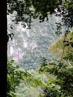
Photo taken from the 2015 report showing the cave from the other side of the Melinau Gorge. We would attempt to climb the clean cliffs to the left. All attempts amongst the trees below had ended with bad rock.

A telephoto from the other side of the gorge. The X marks the approximate spot previous attempts had reached.
A major attempt to reach the entrance was made during the 2020 expedition. In fact, two members of the team spent nearly their entire expedition on the project. This ultimately failed as well but much was learned on how best to approach the climb. The problem was that the only known route to the base of that cliff was via the river which involved a paddle and a wade in swift water that involved 13 river crossings. This was a glorious route when water levels were low but impossible to life threatening when the river flooded. From the river it was then a very steep slog up a gully and forest covered screes to the base of the cliff. Much time was spent trying to find an overland, all weather route, to the same place but this was never achieved. On the one trip in 2020, when I accompanied the climbers as an observer, the need for this all-weather route became obvious. As the climbing floundered on loose rock the rain started to fall. It soon became a free-for-all back down the river before a flood pulse washed us away - or forced us into a night clinging to a tree or rock ledge. We made it back only half an hour before the pulse came.
With all the effort that had already gone into reaching this cave it became impossible to ignore and so it was made a major objective of the Benarat 2024 expedition. My plan was that others would do it and Mark, Will and Frank seemed keen to take it on. They had a couple of attempts at cutting a new track on the north side of the river but found themselves in difficult ground. An attempt up the river proved the level was too high when they were washed off their feet at one of the crossings. Then Mark received news from home which meant he had to return without delay. That left the Corner cave team, as it was known, short of a climber. So, as someone with the right skills, I reluctantly became involved.
The first thing to do was to find that dry route to the cave. However, just finding any route there would do to start off with so with river levels down, me, Will and Frank set off up the gorge on day seven of the expedition. It is a fabulous route in the right conditions. The crystal clear, fast flowing river is a beauty. The forest hangs thickly to the sides and overhead, sunbeams abound, and it offers the largest space around, so makes such a pleasant change to our other walks amongst thick forest.

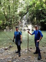
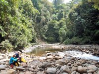
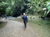
Starting up the gorge with river levels very low.

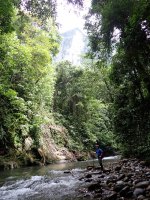
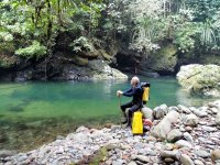
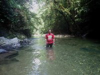
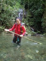
One of many crossings. Great fun in these conditions.

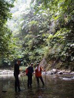
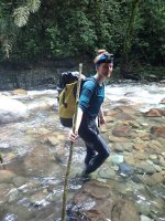
Sticks are essential in the faster flowing water.
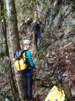
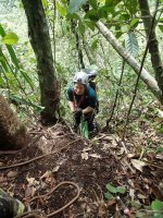
The first kilometre is on a flat track right alongside the water. Then small cliffs pinch in from the sides and the rest of the route zigzags in the river itself. There are 13 river crossings where the main flow must be crossed, usually directly above sections of rapids. Then on a notable bend in the river you strike off due north, up a gully at first, then up steep screes directly to the bottom of the cliff. On this day I cut track and we arrived just below the draughting cave – spot on. A cairn, built in 2020, was still obvious. The previous climbing attempts had all taken place on the righthand side of a cleft which scars the face all the way up to the entrance. These had floundered on bad, dangerous rock. I had a hunch that the lefthand side would present solid rock as this was above the rising cleft and it was not my first experience of a climb up to an entrance in the gorge. Consequently, we found a ‘viewing platform’ on this side where we would start the climb from. There was a strip of clear rock leading up to three consecutive overhangs which all looked passable to the side. That would be the challenge for another day.
Before we left I climbed up into the choked entrance to look at the prospects there. It took a very tricky manoeuvre from a tree to swing into the rift perched just 8m off the ground. Lying inside there was a twisted up sling and snaplink karabiner and it awoke a forgotten memory of losing it on my other trip there four years ago. Back then, I realised, I had dropped it but was not prepared to risk the dodgy climb again just to recover a sling and krab. Now I had. Inside the entrance it was standing height and narrow, but barely 2m long before a complete choke. However, the rocks were clean and all of a manageable size and digging prospects looked excellent – well if we were back home they did. I joked with Will that we should sack off the climb and go get some crowbars.
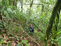
The next day Will was already committed to another trip so I took on the job of finding a dry route to the foot of the cliff. For this I had already recruited Jimmy and Jarah a father and son team from the Penan village down river. Jimmy was a young, modern Penan but his dad was definitely old school Penan still in tune with hunting and gathering. The only way I could brief Jimmy on where I wanted to go was to direct him towards the prominent prow in the upper cliff line. He translated this to Jarah and we set off early. I took a radio to test comms back to our camp 5 base and a GPS to track our…er…track. Jarah led the way and I took the opportunity to slow Jimmy down with a bag containing 100m of rope and 25 hangers and krabs. It certainly didn’t slow him down at all and we were soon setting a brisk pace. We crossed the bridge and Jarah stayed close to the river at first, then, as we reached the rising ground he headed up on a rising traverse. I could see we were following a very feint track, but in several places it was destroyed by tree fall. I sensed this was a track that would lead us right around Benarat, a route I had taken once many years ago. We happened upon an old hunting camp where just the roof pole of the shelter remained. I was looking out for our track from the day before as we were certain to have to cross it. Sure enough, we crossed a gulley shortly after the camp and there were our blazes heading up the hill.

The hunting camp with Jimmy in the background. The horizontal stick is the ridge pole.
We followed it to the top and found the cairn. It had taken just two hours. I tested the radio and made contact with camp 5. After a rest, we set off back leaving the bag of gear on the viewing platform. Jarah cut a new, shorter track back to the hunting camp and from there we followed our same route all the way back. We both marked this track heavily so we could follow it in all conditions. Every few metres of the route you need to be able to see either saplings cut and bent over, blazes on trees, upturned leaves or chops on fallen logs otherwise it is very, very easy to lose the way. The golden rule is never to lose the track. If you can’t see the next mark, go back until you do and search from there for the next one. Never, ever just blunder on in the hope you’ll find it again. That is how to get completely lost.

Jimmy and Jarah at the base of the cliff where we will start the climb. Cairn from 2020 in the foreground.
The climb
This is a story more about a climb than a cave. However, the intention was to discover caverns measureless to man. So how did that turn out?
It was back in 2015 that others, not me, first recorded a cave entrance high in the cliffs on the south east corner of Gunung Benarat. Attempts at that time to reach it were unsuccessful due to the verticality of the cliffs. A photo of the entrance was taken from the other side of the gorge, nearly a kilometre away, which had everyone convinced that the chances of discovering a major cave was high. Adding fuel to this conviction was the discovery near the base of the cliff, directly below, of a strongly draughting choked entrance. A sign, it was thought, that something big must lie behind this part of the mountain.
Photo taken from the 2015 report showing the cave from the other side of the Melinau Gorge. We would attempt to climb the clean cliffs to the left. All attempts amongst the trees below had ended with bad rock.
A telephoto from the other side of the gorge. The X marks the approximate spot previous attempts had reached.
A major attempt to reach the entrance was made during the 2020 expedition. In fact, two members of the team spent nearly their entire expedition on the project. This ultimately failed as well but much was learned on how best to approach the climb. The problem was that the only known route to the base of that cliff was via the river which involved a paddle and a wade in swift water that involved 13 river crossings. This was a glorious route when water levels were low but impossible to life threatening when the river flooded. From the river it was then a very steep slog up a gully and forest covered screes to the base of the cliff. Much time was spent trying to find an overland, all weather route, to the same place but this was never achieved. On the one trip in 2020, when I accompanied the climbers as an observer, the need for this all-weather route became obvious. As the climbing floundered on loose rock the rain started to fall. It soon became a free-for-all back down the river before a flood pulse washed us away - or forced us into a night clinging to a tree or rock ledge. We made it back only half an hour before the pulse came.
With all the effort that had already gone into reaching this cave it became impossible to ignore and so it was made a major objective of the Benarat 2024 expedition. My plan was that others would do it and Mark, Will and Frank seemed keen to take it on. They had a couple of attempts at cutting a new track on the north side of the river but found themselves in difficult ground. An attempt up the river proved the level was too high when they were washed off their feet at one of the crossings. Then Mark received news from home which meant he had to return without delay. That left the Corner cave team, as it was known, short of a climber. So, as someone with the right skills, I reluctantly became involved.
The first thing to do was to find that dry route to the cave. However, just finding any route there would do to start off with so with river levels down, me, Will and Frank set off up the gorge on day seven of the expedition. It is a fabulous route in the right conditions. The crystal clear, fast flowing river is a beauty. The forest hangs thickly to the sides and overhead, sunbeams abound, and it offers the largest space around, so makes such a pleasant change to our other walks amongst thick forest.
Starting up the gorge with river levels very low.
One of many crossings. Great fun in these conditions.
Sticks are essential in the faster flowing water.
The first kilometre is on a flat track right alongside the water. Then small cliffs pinch in from the sides and the rest of the route zigzags in the river itself. There are 13 river crossings where the main flow must be crossed, usually directly above sections of rapids. Then on a notable bend in the river you strike off due north, up a gully at first, then up steep screes directly to the bottom of the cliff. On this day I cut track and we arrived just below the draughting cave – spot on. A cairn, built in 2020, was still obvious. The previous climbing attempts had all taken place on the righthand side of a cleft which scars the face all the way up to the entrance. These had floundered on bad, dangerous rock. I had a hunch that the lefthand side would present solid rock as this was above the rising cleft and it was not my first experience of a climb up to an entrance in the gorge. Consequently, we found a ‘viewing platform’ on this side where we would start the climb from. There was a strip of clear rock leading up to three consecutive overhangs which all looked passable to the side. That would be the challenge for another day.
Before we left I climbed up into the choked entrance to look at the prospects there. It took a very tricky manoeuvre from a tree to swing into the rift perched just 8m off the ground. Lying inside there was a twisted up sling and snaplink karabiner and it awoke a forgotten memory of losing it on my other trip there four years ago. Back then, I realised, I had dropped it but was not prepared to risk the dodgy climb again just to recover a sling and krab. Now I had. Inside the entrance it was standing height and narrow, but barely 2m long before a complete choke. However, the rocks were clean and all of a manageable size and digging prospects looked excellent – well if we were back home they did. I joked with Will that we should sack off the climb and go get some crowbars.
The next day Will was already committed to another trip so I took on the job of finding a dry route to the foot of the cliff. For this I had already recruited Jimmy and Jarah a father and son team from the Penan village down river. Jimmy was a young, modern Penan but his dad was definitely old school Penan still in tune with hunting and gathering. The only way I could brief Jimmy on where I wanted to go was to direct him towards the prominent prow in the upper cliff line. He translated this to Jarah and we set off early. I took a radio to test comms back to our camp 5 base and a GPS to track our…er…track. Jarah led the way and I took the opportunity to slow Jimmy down with a bag containing 100m of rope and 25 hangers and krabs. It certainly didn’t slow him down at all and we were soon setting a brisk pace. We crossed the bridge and Jarah stayed close to the river at first, then, as we reached the rising ground he headed up on a rising traverse. I could see we were following a very feint track, but in several places it was destroyed by tree fall. I sensed this was a track that would lead us right around Benarat, a route I had taken once many years ago. We happened upon an old hunting camp where just the roof pole of the shelter remained. I was looking out for our track from the day before as we were certain to have to cross it. Sure enough, we crossed a gulley shortly after the camp and there were our blazes heading up the hill.
The hunting camp with Jimmy in the background. The horizontal stick is the ridge pole.
We followed it to the top and found the cairn. It had taken just two hours. I tested the radio and made contact with camp 5. After a rest, we set off back leaving the bag of gear on the viewing platform. Jarah cut a new, shorter track back to the hunting camp and from there we followed our same route all the way back. We both marked this track heavily so we could follow it in all conditions. Every few metres of the route you need to be able to see either saplings cut and bent over, blazes on trees, upturned leaves or chops on fallen logs otherwise it is very, very easy to lose the way. The golden rule is never to lose the track. If you can’t see the next mark, go back until you do and search from there for the next one. Never, ever just blunder on in the hope you’ll find it again. That is how to get completely lost.
Jimmy and Jarah at the base of the cliff where we will start the climb. Cairn from 2020 in the foreground.


